Nundubbermere Falls
Location: Sundown
Location: Southern Downs Regional
GPS coordinates: -28.78101,151.69148
Latest update: October 11, 2024 01:33
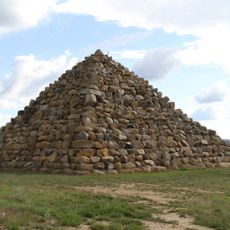
Ballandean Pyramid
16 km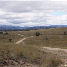
Sundown National Park
8.5 km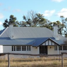
Ballandean Homestead
10.3 km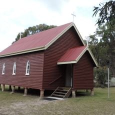
St Denys Anglican Church
24.1 km
Sundown Tin and Copper Mine
9 km
Turtle Waterhole
10.8 km
Wallaby Rocks Waterhole
12.3 km
Sundown Mine (ruin)
8.9 km
Red Rock Gorge Lookout
7.5 km
Rats Castle
9 km
Beecroft Mine (ruin)
9.3 km
The Hell Hole
9.9 km
Pump Waterhole
7.2 km
Rudders Waterhole
6.4 km
Blue Waterhole
11.9 km
Channel Waterhole
12.2 km
Ruins
7.9 km
Twinstar Observatory
14.5 km
"Fruitisforus" Dinosaur
14.9 km
Beehive Waterhole
3.1 km
Ballandean Pyramid
16 km
Double Falls
16.6 km
Split Rock Falls
16.9 km
Symphony Hill Wines
20.5 km
Scenic viewpoint
21 km
Scenic viewpoint
21 km
Heavenly Chocolate
22 km
The Junction
23.2 kmReviews
Visited this place? Tap the stars to rate it and share your experience / photos with the community! Try now! You can cancel it anytime.
Discover hidden gems everywhere you go!
From secret cafés to breathtaking viewpoints, skip the crowded tourist spots and find places that match your style. Our app makes it easy with voice search, smart filtering, route optimization, and insider tips from travelers worldwide. Download now for the complete mobile experience.

A unique approach to discovering new places❞
— Le Figaro
All the places worth exploring❞
— France Info
A tailor-made excursion in just a few clicks❞
— 20 Minutes