Framed
Location: South Waikato District
GPS coordinates: -38.21286,175.86946
Latest update: November 14, 2025 19:40

Lake Maraetai
18.6 km
New Zealand Timber Museum
17.5 km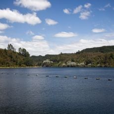
Lake Waipapa
18.8 km
Arahiwi Scenic Reserve
15.4 km
Bakehouse
13.3 km
Water Tower
11.9 km
Skimming Factory (Former)
12.8 km
Arapuni Scenic Reserve
17.4 km
House (Formerly Hotel)
14.6 km
Waotu-Puketurua Playcentre Building
17.6 km
Makomako Stream Scenic Reserve
19 km
Stone Store (Former)
12.3 km
Mangakotaha Stream Scenic Reserve
17.2 km
Putaruru Golf Club
18.2 km
Waipapa Dam climbing crag
18 km
Tokoroa Golf Course
9 km
Disused tunnel
7.5 km
Disused tunnel
9.1 km
Disused tunnel
16.1 km
Access to Waipapa Dam climbing crag
18 km
Mini Golf
440 m
Talking Poles
465 m
Slender Lady
1.6 km
Pine Man of Tokoroa
743 m
Colsons Hill Lookout
483 m
Waterfall
19 km
Waterfall
17.4 km
Waterfall
16.7 kmReviews
Visited this place? Tap the stars to rate it and share your experience / photos with the community! Try now! You can cancel it anytime.
Discover hidden gems everywhere you go!
From secret cafés to breathtaking viewpoints, skip the crowded tourist spots and find places that match your style. Our app makes it easy with voice search, smart filtering, route optimization, and insider tips from travelers worldwide. Download now for the complete mobile experience.

A unique approach to discovering new places❞
— Le Figaro
All the places worth exploring❞
— France Info
A tailor-made excursion in just a few clicks❞
— 20 Minutes