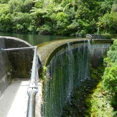
Flume
Location: Upper Hutt City
GPS coordinates: -41.05698,175.18645
Latest update: November 21, 2025 05:09
Birchville Dam Waterfall
9.1 km
Jock Atkins Waterfall
5.7 km
Karapoti Gorge
7.9 km
Kia Enclosure
9.4 km
Force of Nature - Sculpture
9.4 km
Wellington Speedway
5.3 km
The Gardens of Isengard (LotR)
9.3 km
Tractor trailer ride
9.3 km
Arapawa Island goats
9.5 km
Whio aviary
9.5 km
Toe toe aviary
9.4 km
Trout pond
9.4 km
Pond aviary
9.4 km
Kunekune pigs
9.4 km
Te Marua Golf Club
5.7 km
Rimutaka Crossing Soldiers Memorial
7.5 km
Staglands Wildlife Reserve
9.4 km
Scenic viewpoint
9.5 km
Stuart Macaskill Lakes Lookout
4.5 km
Kaitoke Regional Park
1 km
Remutaka Lookout
7.4 km
Akatarawa Bridge (1917-1980's)
8.3 km
Monument
575 m
Stuart Alisdair Macaskill
4.5 km
First Crossing of the Rimutaka Range Monument
7.5 km
Leaving Rivendell Archway
653 m
Memorial, commemorative plaque
7.5 km
Waterfall
6.9 kmReviews
Visited this place? Tap the stars to rate it and share your experience / photos with the community! Try now! You can cancel it anytime.
Discover hidden gems everywhere you go!
From secret cafés to breathtaking viewpoints, skip the crowded tourist spots and find places that match your style. Our app makes it easy with voice search, smart filtering, route optimization, and insider tips from travelers worldwide. Download now for the complete mobile experience.

A unique approach to discovering new places❞
— Le Figaro
All the places worth exploring❞
— France Info
A tailor-made excursion in just a few clicks❞
— 20 Minutes