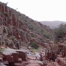
Smooth Falls
Location: Gawler Ranges
Location: Pastoral Unincorporated Area
GPS coordinates: -32.55202,135.32230
Latest update: November 22, 2025 02:13
Gawler Ranges National Park
11.6 km
Gawler Ranges Conservation Park
24.8 km
Yumburra Reservoir
44.7 km
Kaldoonera Hill
42.4 km
Hiltaba Reservoir
46.8 km
Yumburra Park
44.2 km
Thurlga Reservoir
41.5 km
Tcharkuldu Reservoir
35.1 km
Pheasant Hill
26.8 km
Poochera Hill
45.8 km
Yartoo Reservoir
16.8 km
Poldana Station
15.4 km
Little Yandinga Falls
873 m
Old Turn Table
23.9 km
Rock Pools
49.2 km
Original Minnipa Water Supply Dam
35.4 km
Pildappa Rock
23.8 km
Rock Wallaby Falls
729 m
Faraway Falls
518 m
Yandinga Falls
645 m
Pine Well Drive
28.5 km
Tcharkuldu Rock
35 km
Paney Shearing Shed
32 km
Dustys Art Gallery
49.1 km
Mark Bonin Peak - The Lookout
37.2 km
Scenic viewpoint
10.2 km
Organ Pipes
2.8 km
Kolah Mirica Falls
23.8 kmReviews
Visited this place? Tap the stars to rate it and share your experience / photos with the community! Try now! You can cancel it anytime.
Discover hidden gems everywhere you go!
From secret cafés to breathtaking viewpoints, skip the crowded tourist spots and find places that match your style. Our app makes it easy with voice search, smart filtering, route optimization, and insider tips from travelers worldwide. Download now for the complete mobile experience.

A unique approach to discovering new places❞
— Le Figaro
All the places worth exploring❞
— France Info
A tailor-made excursion in just a few clicks❞
— 20 Minutes