Steep & rough track
Location: Lake Borumba
Location: Gympie Regional
GPS coordinates: -26.51140,152.59607
Latest update: November 2, 2025 09:15
Mary Valley Heritage Railway
9.8 km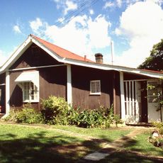
Kenilworth Homestead
15.8 km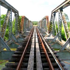
Imbil Railway Bridge
9.9 km
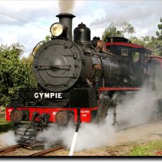
Proud Mary Steam Train
9.8 km
Puzzles on Yabba
10 km
Giant Fig Tree
15.6 km
Giant Fig Tree
15.6 km
Steep Track
15.9 km
Rough Incline
17.1 km
Steep Track
10 km
Steep Track
9.6 km
Steep
13.8 km
Stirlings Crossing
3.9 km
Historic Railway Bridge
13.1 km
Gold Mine
15.8 km
Steep Track
1.8 km
Strangler Cairn
16 km
Booloumba Lookout
16.8 km
Mount Allan Fire Tower
14.8 km
Summer Falls
13.4 km
Imbil Lookout
9.3 km
Scenic viewpoint
15.6 km
Scenic viewpoint
15.6 km
Scenic viewpoint
15.6 km
Scenic viewpoint
12.7 km
Scenic viewpoint
1.3 km
Frank 400 Memorial
4.6 km
War memorial, memorial
16.2 kmReviews
Visited this place? Tap the stars to rate it and share your experience / photos with the community! Try now! You can cancel it anytime.
Discover hidden gems everywhere you go!
From secret cafés to breathtaking viewpoints, skip the crowded tourist spots and find places that match your style. Our app makes it easy with voice search, smart filtering, route optimization, and insider tips from travelers worldwide. Download now for the complete mobile experience.

A unique approach to discovering new places❞
— Le Figaro
All the places worth exploring❞
— France Info
A tailor-made excursion in just a few clicks❞
— 20 Minutes