Old Nullarbor Roadhouse
Location: Nullarbor
Location: Pastoral Unincorporated Area
GPS coordinates: -31.44990,130.89682
Latest update: November 22, 2025 03:34

Koonalda Cave
96.4 km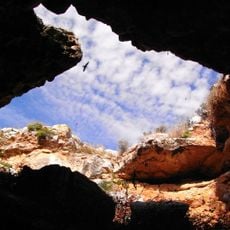
Murrawijinie Cave
9.5 km
Great Australian Bight Marine National Park
50.6 km
Dog Fence Beach
96.4 km
Clay Dam Cave
95.9 km
Koomooloobooka Cave
123.9 km
The Catacombs
44.3 km
Bildoolja Cave
126.7 km
Knowles Cave
43.6 km
Murrawijinie Caves
9.4 km
Diprose Cave
63.2 km
Weekes Cave
93.2 km
Jimmies Cave
20.5 km
Koonalda Cave
100.8 km
Nullarbor Links "Dingos Den"
142 m
Sign: "Nullarbor eastern end of treeless plain"
17.8 km
Old School Site
130.4 km
Head of Bight Whale Centre
20.7 km
Aboriginal Art Gallery
87 km
Dog Fence beach
95.6 km
Koonalda Cave
100.7 km
Scenic Lookout Number 2
107.7 km
Scenic Lookout Number 1
72.8 km
133k Peg Scenic Lookout
52 km
52k Peg Scenic Lookout
131.1 km
Scenic viewpoint
63.4 km
Koonalda Homestead
98.6 km
Unknown
47.8 kmReviews
Visited this place? Tap the stars to rate it and share your experience / photos with the community! Try now! You can cancel it anytime.
Discover hidden gems everywhere you go!
From secret cafés to breathtaking viewpoints, skip the crowded tourist spots and find places that match your style. Our app makes it easy with voice search, smart filtering, route optimization, and insider tips from travelers worldwide. Download now for the complete mobile experience.

A unique approach to discovering new places❞
— Le Figaro
All the places worth exploring❞
— France Info
A tailor-made excursion in just a few clicks❞
— 20 Minutes