Руіны вадзянога млына ХІХ ст.
Location: Сваткаўскі сельскі Савет
GPS coordinates: 54.71642,26.93772
Latest update: October 25, 2025 07:20

Church of the Holy Trinity in Kniahinin
15.3 km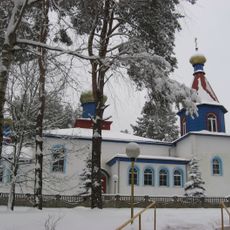
Orthodox church of the Transfiguration of Jesus Christ in Zanarač
14.6 km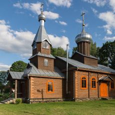
Saint Joseph church in Iža
12.9 km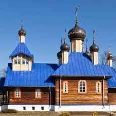
Church of the Cathedral of the Belarusian Saints
14 km
Chapel St. Nicholas in Karalieŭcy
13.5 km
Камень з ямкамі
14 km
Krzyż kamienny
12.1 km
Kamienny krzyż
12.9 km
Kamień memorialny na miejscu bitwy w 1863r. (Powstańców Styczniowych), „Bity Łoh”
13.5 km
Zespół dworsko-parkowy Lubańskich
13.9 km
Kaplica
11.4 km
Сцебярацкія Валы
4.9 km
Głaz
3.7 km
Валун «Седлавы камень Занарачанскі»
12.9 km
Dwór
13.9 km
Wielki głaz kuźmiczowski
12.2 km
Zabudowa gospodarcza
13.9 km
Kultowy głaz Zanaracki
7 km
Grób Władysława Piłsudskiego
10.6 km
Вялікі камень дзядзіцкі
14 km
Remains of the foundation of the old distillery
10.3 km
Чортаў камень
10.6 km
Grodzisko
12.7 km
Alley in honor of the 70th anniversary of G. A. Kolbun (2019)
10.3 km
Валун Мацкійскі
11.7 km
Вялікі камень Качэргінскі
14.8 km
Statue, Work of art
13.9 km
Кратэр возера
15 kmReviews
Visited this place? Tap the stars to rate it and share your experience / photos with the community! Try now! You can cancel it anytime.
Discover hidden gems everywhere you go!
From secret cafés to breathtaking viewpoints, skip the crowded tourist spots and find places that match your style. Our app makes it easy with voice search, smart filtering, route optimization, and insider tips from travelers worldwide. Download now for the complete mobile experience.

A unique approach to discovering new places❞
— Le Figaro
All the places worth exploring❞
— France Info
A tailor-made excursion in just a few clicks❞
— 20 Minutes