Roche des Hats
Location: Dommartin-lès-Remiremont
GPS coordinates: 47.98975,6.65925
Latest update: October 11, 2024 03:03
Saint Mont
4 km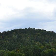
Le Saint-Mont
4 km
Terrae Genesis
2.9 km
Église Saint-Louis de Vecoux
2 km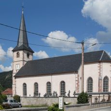
Église Saint-Amé de Saint-Amé
4 km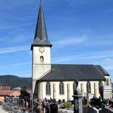
Église Saint-Laurent de Dommartin-lès-Remiremont
1.5 km
Croix de Révillon
3.6 km
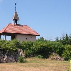
Chapelle du Saint-Mont
4 km
Haute Borne
3.9 km
Tumulus de Vecoux / Table d'orientation
2.7 km
Scenic viewpoint
3.7 km
Le Saint-Mont
4 km
Point de vue
1.1 km
Statue de la Vierge du Mai / table d'orientaion
1.4 km
Balcon du Solem
3.9 km
Wayside cross
3.9 km
Monument aux morts
1.6 km
Castrum Habendum
3.9 km
Wayside cross, Christianity
3.2 km
Wayside cross
3 km
Memorial
2 km
Monument aux morts
4 km
Stèle de L'Aviateur
3.1 km
Wayside cross, Historical Monument, monument historique inscrit
3.6 km
Vierge du Longfaing
3.5 km
Wayside cross
4 km
Wayside shrine
3.5 km
Chapelle Saint-Michel
4.1 kmReviews
Visited this place? Tap the stars to rate it and share your experience / photos with the community! Try now! You can cancel it anytime.
Discover hidden gems everywhere you go!
From secret cafés to breathtaking viewpoints, skip the crowded tourist spots and find places that match your style. Our app makes it easy with voice search, smart filtering, route optimization, and insider tips from travelers worldwide. Download now for the complete mobile experience.

A unique approach to discovering new places❞
— Le Figaro
All the places worth exploring❞
— France Info
A tailor-made excursion in just a few clicks❞
— 20 Minutes