Rochers Baie du Kernic
Location: Plounévez-Lochrist
GPS coordinates: 48.64751,-4.21793
Latest update: November 16, 2025 08:13
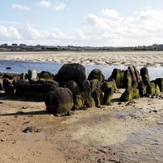
Kernic gallery grave
1 km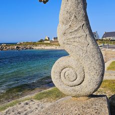
Hippocampe
2.5 km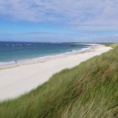
Plages de Keremma
2.5 km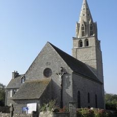
Chapelle de Lochrist-an-Izevel
2.3 km
Calvaire de Menez-ar-Plour
1 km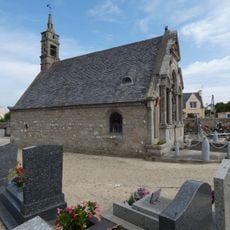
Chapelle Notre-Dame-du-Mont-Calvaire de Plouescat
3.2 km
Scenic viewpoint
970 m
Scenic viewpoint
1 km
Scenic viewpoint
1 km
Point de vue sur la Baie
1.8 km
Stèle gauloise
1.3 km
Menhir de Prat Meur
2 km
Plage de Porsmeur
1.5 km
Menhir porz ar streat
2.4 km
Puits
2.4 km
Wayside cross
2.2 km
Croix de Kergoarat
2.4 km
Menhir de Brétouaré (B)
1.5 km
Menhir de Brétouaré
1.4 km
Plage de Keremma
1.8 km
Wayside cross, Christianity, Catholic church building
2.4 km
Wayside cross, Christianity, Catholic church building
891 m
Christianity, Catholic church building, wayside cross
1.9 km
Wayside cross
1.7 km
Catholic church building, wayside cross, Christianity
3 km
Catholic church building, wayside cross, Christianity
2.7 km
Catholic church building, wayside cross, Christianity
3.3 km
Catholic church building, wayside cross, Christianity
2.2 kmReviews
Visited this place? Tap the stars to rate it and share your experience / photos with the community! Try now! You can cancel it anytime.
Discover hidden gems everywhere you go!
From secret cafés to breathtaking viewpoints, skip the crowded tourist spots and find places that match your style. Our app makes it easy with voice search, smart filtering, route optimization, and insider tips from travelers worldwide. Download now for the complete mobile experience.

A unique approach to discovering new places❞
— Le Figaro
All the places worth exploring❞
— France Info
A tailor-made excursion in just a few clicks❞
— 20 Minutes