Römischer Brunnen
Location: Farschweiler
Website: https://kulturdb.de/einobjekt.php?id=39075
Website: https://kulturdb.de/einobjekt.php?id=39075
GPS coordinates: 49.71370,6.83387
Latest update: November 20, 2025 00:57

Klostermühle
2.2 km
Römer-Keltenpfad
720 m
Menhir von Farschweiler
1 km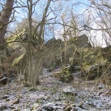
Herler Felsen
1.9 km
Kreuzwegstation VI
1.3 km
Kreuzwegstation VII
1.2 km
Herler Kapellchen
1.8 km
Archaeological site
915 m
Menhir
1.1 km
Kreuzwegstation I
1.8 km
Kreuzwegstation II
1.6 km
Kreuzwegstation III
1.6 km
Kreuzwegstation IV
1.4 km
Kreuzwegstation V
1.3 km
Herler Felsen
1.9 km
Archaeological site
937 m
Kreuzwegstation IX
984 m
Kreuzwegstation VIII
1.1 km
Kreuzwegstation X
878 m
Kreuzwegstation XI
808 m
Kreuzwegstation XII
745 m
Kreuzwegstation XIV
640 m
Kreuzwegstation XIII
633 m
Archaeological site
961 m
Archaeological site
979 m
Archaeological site
890 m
Archaeological site
877 m
Archaeological site
845 mReviews
Visited this place? Tap the stars to rate it and share your experience / photos with the community! Try now! You can cancel it anytime.
Discover hidden gems everywhere you go!
From secret cafés to breathtaking viewpoints, skip the crowded tourist spots and find places that match your style. Our app makes it easy with voice search, smart filtering, route optimization, and insider tips from travelers worldwide. Download now for the complete mobile experience.

A unique approach to discovering new places❞
— Le Figaro
All the places worth exploring❞
— France Info
A tailor-made excursion in just a few clicks❞
— 20 Minutes