Burg-Quelle
Location: Plaidt
Accessibility: Non accessibile in sedia a rotelle
GPS coordinates: 50.38583,7.38228
Latest update: November 22, 2025 05:03
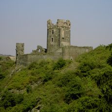
Burg Wernerseck
1.5 km
Rauscherpark
1.3 km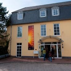
Vulkanpark Infozentrum
1.4 km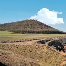
Korretsberg
2.2 km
Miesenheim Jewish Cemetary
2.5 km
Michelberg
2.6 km
Plaidter Hummerich
934 m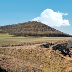
Korretsberg
1.9 km
Burgruine Wernerseck
1.5 km
Plaidter Hummerich
1 km
Unteres Mittelrheingebiet
1.3 km
Scenic viewpoint, shelter
2.2 km
Christianity, wayside shrine
1.5 km
Bench, scenic viewpoint
2.2 km
Krufter Bachtal
1.3 km
Scenic viewpoint
543 m
Scenic viewpoint
1.5 km
Scenic viewpoint
542 m
Wayside shrine, Christianity
1.5 km
Memorial
2.4 km
Freibad Pellenz
1.8 km
Wayside shrine
1.3 km
Wayside cross
1.7 km
Wayside shrine, Christianity
506 m
Christianity, wayside shrine
344 m
Stele, memorial
693 m
Christianity, wayside shrine
163 m
Wayside cross
560 mReviews
Visited this place? Tap the stars to rate it and share your experience / photos with the community! Try now! You can cancel it anytime.
Discover hidden gems everywhere you go!
From secret cafés to breathtaking viewpoints, skip the crowded tourist spots and find places that match your style. Our app makes it easy with voice search, smart filtering, route optimization, and insider tips from travelers worldwide. Download now for the complete mobile experience.

A unique approach to discovering new places❞
— Le Figaro
All the places worth exploring❞
— France Info
A tailor-made excursion in just a few clicks❞
— 20 Minutes