Bodenprofil
Location: Troisdorf
Opening Hours: 24/7
GPS coordinates: 50.83538,7.16644
Latest update: November 23, 2025 11:36
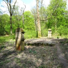
Eremitage Troisdorf
972 m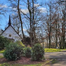
Waldfriedhof
1.7 km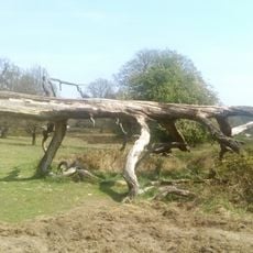
Wahner Heide im Rhein-Sieg-Kreis
355 m
Fliegen-Berg
882 m
Telegraphen-Berg
405 m
Moltke-Berg
432 m
Ravens-Berg
706 m
Krammetshügel
649 m
LSG-Stadtwald Troisdorf
1.7 km
Scenic viewpoint
1.8 km
Christianity, Catholic church building, wayside shrine
969 m
Waldtelefon
1.6 km
Globus
1.7 km
Tumbleweed
1.7 km
Wald- und Vogelpark
1.7 km
Scenic viewpoint
383 m
Siebengebirgsblick
863 m
Ringelstein
959 m
Vogelpark
1.6 km
Wayside cross
962 m
Wayside cross
1.4 km
Kreuz
1.6 km
Flüchtlingsfrau mit Kind
1.7 km
Kreuz
1.7 km
Wayside cross
1.2 km
Stompe Kröksje
820 m
Ruins
480 m
Ruins
860 mReviews
Visited this place? Tap the stars to rate it and share your experience / photos with the community! Try now! You can cancel it anytime.
Discover hidden gems everywhere you go!
From secret cafés to breathtaking viewpoints, skip the crowded tourist spots and find places that match your style. Our app makes it easy with voice search, smart filtering, route optimization, and insider tips from travelers worldwide. Download now for the complete mobile experience.

A unique approach to discovering new places❞
— Le Figaro
All the places worth exploring❞
— France Info
A tailor-made excursion in just a few clicks❞
— 20 Minutes