Mosestafel
Location: Kappel-Grafenhausen
GPS coordinates: 48.23469,7.91158
Latest update: October 11, 2024 03:50
Kloster Ettenheimmünster
2.8 km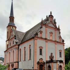
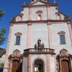
St. Landelin
2.8 km
Dörlinbacher Grund - Münstergraben
837 m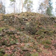
Heidenkeller
3 km
Schindlenbühl
3.8 km
Gisenburg
2.1 km
Aussichtsturm Windkraft
3.6 km
Dörlinbacher Grund
858 m
St. Johannes
3.5 km
Rollberg
3.5 km
Wayside cross
3.6 km
Catholic church building, wayside shrine, Christianity
3.6 km
Catholic church building, wayside shrine, Christianity
3.5 km
Felsenhaus
2.9 km
Pyramide
3.5 km
Lourdesgrotte
3.5 km
Noch lebt Aegidius weiter
3.1 km
Heil- und Waldkräutergarten
3.6 km
Memorial, commemorative plaque
3.1 km
Labyrinth Freiamt
3.6 km
Wayside cross
2.4 km
Aussichtsturm Schnürbuck
3.6 km
Installation artwork, Work of art
2.2 km
Helgenstöckle
3.7 km
Totenruhstein anno 1656
1.9 km
Catholic church building, wayside shrine, Christianity
3.8 km
Catholic church building, wayside cross, Christianity
3.8 km
Kreuzstein
3.8 kmReviews
Visited this place? Tap the stars to rate it and share your experience / photos with the community! Try now! You can cancel it anytime.
Discover hidden gems everywhere you go!
From secret cafés to breathtaking viewpoints, skip the crowded tourist spots and find places that match your style. Our app makes it easy with voice search, smart filtering, route optimization, and insider tips from travelers worldwide. Download now for the complete mobile experience.

A unique approach to discovering new places❞
— Le Figaro
All the places worth exploring❞
— France Info
A tailor-made excursion in just a few clicks❞
— 20 Minutes