Historischer Ziehbrunnen
Location: Hamminkeln
Website: https://dingdener-heide.com/index.php/attraktionen/ziehbrunnen
GPS coordinates: 51.77543,6.67078
Latest update: November 24, 2025 20:13
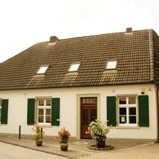
Humberghaus
4.1 km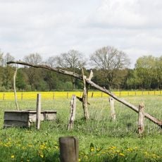
Dingdener Heide
193 m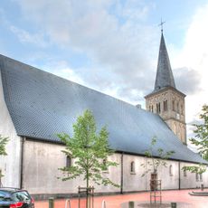
St. Pankratius
4.2 km
Kleine Dingdener Heide
2.2 km
Büngernsche und Dingdener Heide
857 m
Im Venn
4.7 km
Bachtal am Hasenkamp
4.4 km
LSG-Biemenhorst - Buengern - Krommert
3.5 km
Stapelbach
3.8 km
LSG-Ruempingbach
4.1 km
Hemmings-Schlinke
3.2 km
LSG-Stammshutte
1.9 km
Mumbecker Bach
2 km
Auewald am Essingholtbach
2.2 km
LSG-Dingender und Bruener Hoehen
2.1 km
Heimathaus Dingden
4.1 km
LSG-Honselbach
3.2 km
Das Ding in der Heide
1.3 km
Aussichtskanzel Zum Schießstand
1.4 km
Wayside cross
3.3 km
Wayside shrine
3.5 km
Turmwindmühle Nordbrock
3.8 km
Wayside cross
2.8 km
Wayside shrine
2.5 km
Wayside cross
3.6 km
Wayside cross
3.2 km
Wayside cross
3.4 km
Memorial
3.3 kmReviews
Visited this place? Tap the stars to rate it and share your experience / photos with the community! Try now! You can cancel it anytime.
Discover hidden gems everywhere you go!
From secret cafés to breathtaking viewpoints, skip the crowded tourist spots and find places that match your style. Our app makes it easy with voice search, smart filtering, route optimization, and insider tips from travelers worldwide. Download now for the complete mobile experience.

A unique approach to discovering new places❞
— Le Figaro
All the places worth exploring❞
— France Info
A tailor-made excursion in just a few clicks❞
— 20 Minutes