Limpsfield Common Family and Easy Access Trails
Location: Tandridge
Operator: National Trust
GPS coordinates: 51.24998,0.04341
Latest update: November 20, 2025 18:08

Strange Cottage
1.6 km
Moorhouse Cottages
1.3 km
Lombarton Cottage
575 m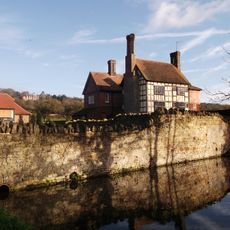
Tenchleys Manor
1.2 km
The Gate House
1.5 km
The Mill House
202 m
The Salt Box
670 m
Ridlands Farm House
469 m
Camp at Squerryes Park
1.6 km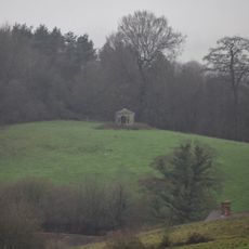
Gazebo About 330 Yards West Of Squerryes Court On Top Of Hill At Other Side Of Road
1.7 km
Boulthurst Farm House
1.7 km
Comforts
1.4 km
The Moat Farm House Including Barn Attached To Right
1.4 km
Linear earthwork 230m south west of Covers Farm
1.5 km
Swaynesland Barn
1.6 km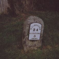
Milestone, Redwood, 400m E of village; by entrance to Redwood
1.5 km
Barn 20 Yards Of The Moat Farm House
1.4 km
Moorhouse Cottages Moorhouse Farm House
1.3 km
Lockes Cottage
1.6 km
Orchard House
1.6 km
Trevereux House
635 m
Stable Block 10 Yards East Of Trevereux House
1.2 km
Dell Cottage
1.5 km
Champions Place, Including Attached Terrace, Terrace Walling And Steps
596 m
Friars Cottage
1.6 km
The Old House
1.2 km
Grants
1.7 km
Limpsfield Chart Golf Club
1.4 kmReviews
Visited this place? Tap the stars to rate it and share your experience / photos with the community! Try now! You can cancel it anytime.
Discover hidden gems everywhere you go!
From secret cafés to breathtaking viewpoints, skip the crowded tourist spots and find places that match your style. Our app makes it easy with voice search, smart filtering, route optimization, and insider tips from travelers worldwide. Download now for the complete mobile experience.

A unique approach to discovering new places❞
— Le Figaro
All the places worth exploring❞
— France Info
A tailor-made excursion in just a few clicks❞
— 20 Minutes