Drinkfield Marsh Nature Reserve
Location: Darlington
Website: http://www.friendsofdrinkfieldmarsh.co.uk/
Website: http://friendsofdrinkfieldmarsh.co.uk
GPS coordinates: 54.55116,-1.55707
Latest update: November 16, 2025 22:00
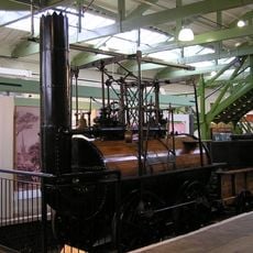
Stockton and Darlington Railway No. 1 “Locomotion”
1.7 km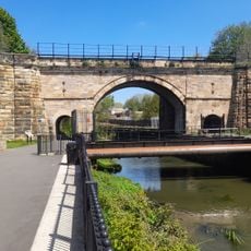
Skerne Bridge
1.9 km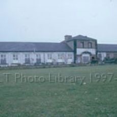
Hopetown Carriage Works
1.7 km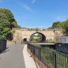
Head of Steam Darlington Railway Museum
1.7 km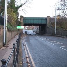
Bridge over North Road, Darlington
1.8 km
Stable 30 Metres North Of High Beaumont Hill Farmhouse
1.9 km
Honey Pot House
651 m
1 and 2, Mcnay Street
1.8 km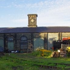
Goods Shed East South East Of North Road Station
1.8 km
Cleveland Street, opp. York Street
2 km
Cemetery lodge, gate piers, gates and flanking walls
931 m
Cemetery chapels and porte-cochere
736 m
Huntershaw
521 m
Cart Shed With Loose Box And Pigsty 5 Metres North Of High Beaumont Hill Farmhouse
1.9 km
Walls, Gatepiers And Gates To Stooperdale Offices
1.8 km
Stooperdale Offices
1.7 km
Essoldo Darlington
1.1 km
North Cemetery House
883 m
Rise Carr County Primary School
966 m
Manor House Ruins And Wall, 70 Metres South East Of Whessoe Grange Farmhouse
1.2 km
Cemetery commemorative column
849 m
Stockton And Darlington Railway Carriage Works
1.7 km
Little Whessoe occupation bridge
1.6 km
Wall To North Of Number 279
638 m
Darlington Railway Centre and Museum
1.7 km
Darlington Golf Course
1.9 km
Plover
2 km
Work of art
808 mReviews
Visited this place? Tap the stars to rate it and share your experience / photos with the community! Try now! You can cancel it anytime.
Discover hidden gems everywhere you go!
From secret cafés to breathtaking viewpoints, skip the crowded tourist spots and find places that match your style. Our app makes it easy with voice search, smart filtering, route optimization, and insider tips from travelers worldwide. Download now for the complete mobile experience.

A unique approach to discovering new places❞
— Le Figaro
All the places worth exploring❞
— France Info
A tailor-made excursion in just a few clicks❞
— 20 Minutes