Utcakép
Location: Kerkaszentkirály
GPS coordinates: 46.50041,16.58071
Latest update: November 19, 2025 04:06

Kamniti križ, Pince
5.3 km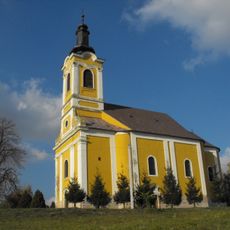
Saint Nicholas Church, Kerkaszentmiklós, Tornyiszentmiklós
3 km
Prazgodovinska naselbina Pod Grunti
5.5 km
Klet Pince 110
5.7 km
Vaški zvonik
5.3 km
Utcakép
5.5 km
Deszka kápolna
6.1 km
Mura folyó
4.7 km
Jaka glava
4.7 km
Utcakép
1.8 km
Józsalak
5.2 km
Kerka part, falulegelő
1.8 km
Horgásztó
34 m
Kankalin tanösvény
5.5 km
Csernec-holtág
3.3 km
Utcakép, magtár
4.7 km
Bányató
6.2 km
Utcakép
6.1 km
Cross-motor pálya
5 km
Prés
4.8 km
Mária-szobor
2.4 km
Statue, Work of art
6 km
Work of art
4.1 km
Work of art
5 km
Statue, Work of art
2.2 km
Vörcsök-hegyi kilátó
2.8 km
Látófa kilátás
5.8 km
Memorial
5.4 kmReviews
Visited this place? Tap the stars to rate it and share your experience / photos with the community! Try now! You can cancel it anytime.
Discover hidden gems everywhere you go!
From secret cafés to breathtaking viewpoints, skip the crowded tourist spots and find places that match your style. Our app makes it easy with voice search, smart filtering, route optimization, and insider tips from travelers worldwide. Download now for the complete mobile experience.

A unique approach to discovering new places❞
— Le Figaro
All the places worth exploring❞
— France Info
A tailor-made excursion in just a few clicks❞
— 20 Minutes