Natūraliai susiformavusi ąžuolų alėja
Location: Alytaus seniūnija
GPS coordinates: 54.51380,24.08400
Latest update: November 15, 2025 10:29
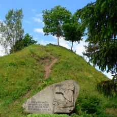
Punia hillfort
450 m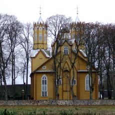
Church of St. Peter and St. Paul, Nemajūnai
5.1 km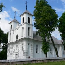
Church of St. James the Apostle, Punia
790 m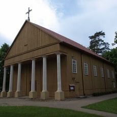
Church of the Holy Trinity, Rumbonys
5.6 km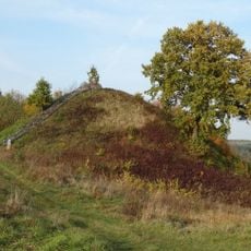
Rumbonys hillfort
5 km
Margaravos piliakalnis
6.5 km
Šaltinėnų piliakalnis
6.8 km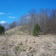
Nemajūnų piliakalnis
5.9 km
Szylany - Ostra Góra
4.4 km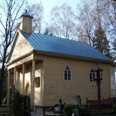
Nemajūnai
5.4 km
Chapel in Rumbonys
5.6 km
Kružiūnų piliakalnis
5.6 km
Pasakų takas
3 km
Punios šilo pažintinė trasa
2.9 km
Punios kraštovaizdžio draustinis
363 m
Žaltės slėnis
1.2 km
Dainavos apygardos štabo bunkeris
267 m
Klebono akmuo
6.7 km
Panemuninkų piliakalnis
2.4 km
Bundorių piliakalnis
3.9 km
Work of art, sculpture
811 m
Sculpture, Work of art
936 m
Work of art
48 m
Work of art
180 m
Siponių atodanga
5.7 km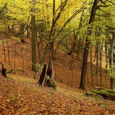
Panemuninkų skardis
1.9 km
Punios piliakalnio viršutinė aikštelė
518 m
Ąžuolų alėja
68 mReviews
Visited this place? Tap the stars to rate it and share your experience / photos with the community! Try now! You can cancel it anytime.
Discover hidden gems everywhere you go!
From secret cafés to breathtaking viewpoints, skip the crowded tourist spots and find places that match your style. Our app makes it easy with voice search, smart filtering, route optimization, and insider tips from travelers worldwide. Download now for the complete mobile experience.

A unique approach to discovering new places❞
— Le Figaro
All the places worth exploring❞
— France Info
A tailor-made excursion in just a few clicks❞
— 20 Minutes