Svilės kraštovaizdžio takas
Location: Šaukėnų seniūnija
Website: https://www.krpd.lt/index.php?module=editable&action=separated&id=815
Operator: Kurtuvėnų regioninio parko direkcija
Website: https://krpd.lt/index.php?module=editable&action=separated&id=815
GPS coordinates: 55.84011,22.94247
Latest update: November 17, 2025 21:48
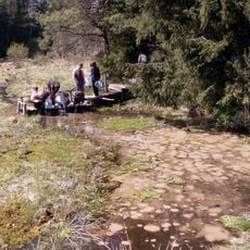
Svilė springs
70 m
Varputėnai Manor
6 km
Martyno akmuo
3.4 km
Church of the Holy Trinity, Šaukėnai
5.1 km
Vainagių piliakalnis
5.4 km
Kalniškių hillfort
5.2 km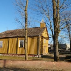
Church of St. Anthony of Padua, Varputėnai
5.7 km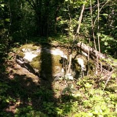
Linartų akmuo
4.5 km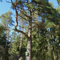
Šaukėnų pušis
4.1 km
Gabriejolės piliakalnis
2.9 km
Šaukėnų II tvenkinys
3.9 km
Juodlės pažintinis takas
3.2 km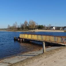
Šaukėnų I tvenkinys
4.1 km
Mingėlių tvenkinys
4.7 km
Kalniškių karjeras
4.2 km
Martyno akmuo
3.7 km
Rododendrariumas
5.1 km
Karalių kalnas
3.9 km
Vainagių pažintinis takas
5.2 km
Gilvyčių tvenkinys
5.5 km
Pustlaukio duobių pažintinis takas
4.1 km
Girnikių pušis
5.9 km
Work of art, sculpture
5.3 km
Work of art, installation artwork
5.4 km
Dubysos-Ventos perkaso regykla
4.4 km
Pustlaukio duobės regykla
4.1 km
Linartų akmuo
4.5 km
Šaukėnų pušis
4.1 kmReviews
Visited this place? Tap the stars to rate it and share your experience / photos with the community! Try now! You can cancel it anytime.
Discover hidden gems everywhere you go!
From secret cafés to breathtaking viewpoints, skip the crowded tourist spots and find places that match your style. Our app makes it easy with voice search, smart filtering, route optimization, and insider tips from travelers worldwide. Download now for the complete mobile experience.

A unique approach to discovering new places❞
— Le Figaro
All the places worth exploring❞
— France Info
A tailor-made excursion in just a few clicks❞
— 20 Minutes