
Bruknynės vandens malūnas
Location: Kaltanėnų seniūnija
GPS coordinates: 55.21916,25.98976
Latest update: November 15, 2025 09:56
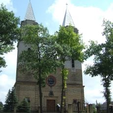
Church of Virgin Mary of Sorrows in Švenčionėliai
6.6 km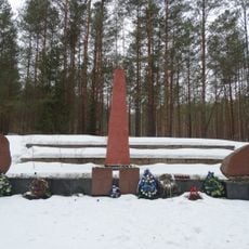
Švenčionėliai Holocaust Memorial
5.8 km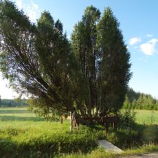
Obelų Ragas junipers
8.3 km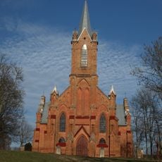
Church of Saint Mary of the Angels, Kaltanėnai
3.7 km
Gaigalinio kadagys
8.6 km
Labanoro pušys
10.2 km
Kretuonių antrasis ąžuolas
4.1 km
Pagilūtė Telmological Reserve
4.5 km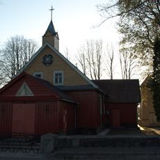
Church of Saint Isidore, Reškutėnai
8.8 km
Kretuono gyvenvietės
6.9 km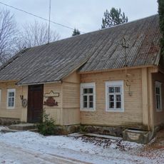
Reškutėnų muziejus
9.2 km
Paduobės piliakalnis
9.7 km
Grodzisko w Reszkutanach
8.3 km
Kretuonių pirmasis ąžuolas
4 km
Grodzisko w Daukszach
10.1 km
Góra zamkowa w Rogoszczyźnie
10.2 km
Partizanų žuvimo vieta
10.2 km
Pakretuonio tvenkinys
7.7 km
Šventelės tvenkinys
1.6 km
Girutiškis Nature Strict Reserve
8.1 km
Kiauneliškis Nature Reserve
9.7 km
1863 m. sukilėlių pirmasis kapas
6.5 km
Šventežerio pažintinis takas
2.5 km
Bajorų miško takas
8.5 km
1863 m. sukilėlių antrasis kapas
6.7 km
Švenčionėliai
5 km
Kaltanėnai
2.5 km
Lygumų apžvalgos bokštas
10.2 kmReviews
Visited this place? Tap the stars to rate it and share your experience / photos with the community! Try now! You can cancel it anytime.
Discover hidden gems everywhere you go!
From secret cafés to breathtaking viewpoints, skip the crowded tourist spots and find places that match your style. Our app makes it easy with voice search, smart filtering, route optimization, and insider tips from travelers worldwide. Download now for the complete mobile experience.

A unique approach to discovering new places❞
— Le Figaro
All the places worth exploring❞
— France Info
A tailor-made excursion in just a few clicks❞
— 20 Minutes