Nadgobni mramor
Location: Opština Andrijevica
GPS coordinates: 42.64098,19.67400
Latest update: November 22, 2025 14:49

Maja e Grebenit
9.5 km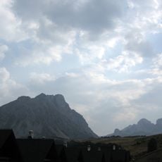
Kučki Kom
5.1 km
Mali Mojan
1.1 km
Ilijina Glava
3.6 km
Mirakova Peć
9.5 km
Vidikovac
9.2 km
Wayside cross
5.9 km
Ruins of Katun Mojan
160 m
Stari mramori - Groblje
32 m
Scenic viewpoint
5.4 km
Viewpoint to the canyon with a waterfall
8.8 km
Scenic viewpoint
2.8 km
Scenic viewpoint
4.9 km
Vidikovac Varda
5.4 km
Varri i Memit
2.8 km
Glavica
6.3 km
Vodenica Đerkovića
9.4 km
Wayside shrine
5.9 km
Wayside cross
5.2 km
Mitrović Bracan Memorijal
6.6 km
Waterfall
5.3 km
Waterfall
5.4 km
Waterfall
8.8 km
Slapovi
8.8 km
Slapovi
7.6 km
Slapovi
282 m
Slapovi
596 m
Waterfall
9.4 kmReviews
Visited this place? Tap the stars to rate it and share your experience / photos with the community! Try now! You can cancel it anytime.
Discover hidden gems everywhere you go!
From secret cafés to breathtaking viewpoints, skip the crowded tourist spots and find places that match your style. Our app makes it easy with voice search, smart filtering, route optimization, and insider tips from travelers worldwide. Download now for the complete mobile experience.

A unique approach to discovering new places❞
— Le Figaro
All the places worth exploring❞
— France Info
A tailor-made excursion in just a few clicks❞
— 20 Minutes