Młyn turbinowy
Location: Rozbark
Location: Bytom
GPS coordinates: 50.33979,18.95694
Latest update: October 11, 2024 05:56
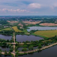
Żabie Doły
835 m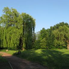
Adam Mickiewicz Park in Bytom
1.8 km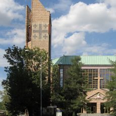
Church of Saint Anne in Bytom
1.5 km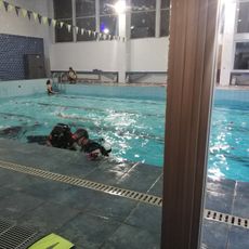
Centrum Działalności Podwodnej
1.5 km
Mural, Work of art
1.8 km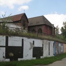
Rozbark mine retaining wall
1.8 km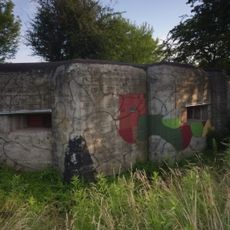
Heavy combat bunker in Chorzów-Maciejkowice
1.7 km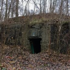
Combat bunker No. 3 in Bytom
1.6 km
Macierzyństwo
1.4 km
Schron bojowy nr 3 Punkt Oporu „Łagiewniki” OWŚ
1.6 km
Scenic viewpoint
1.2 km
OWŚ
1.3 km
Scenic viewpoint
1.3 km
Scenic viewpoint
1.1 km
OWŚ
1.5 km
Scenic viewpoint
1 km
Mural, Work of art
1.5 km
Scenic viewpoint
982 m
Waterfall
1.5 km
Scenic viewpoint
1.1 km
OWŚ
1.6 km
Scenic viewpoint
973 m
Schron bojowy nr 1 Punkt Oporu „Łagiewniki” OWŚ
1.7 km
Scenic viewpoint
968 m
Rodzina
1.7 km
Scenic viewpoint
822 m
OWŚ
1.8 km
Scenic viewpoint
762 mReviews
Visited this place? Tap the stars to rate it and share your experience / photos with the community! Try now! You can cancel it anytime.
Discover hidden gems everywhere you go!
From secret cafés to breathtaking viewpoints, skip the crowded tourist spots and find places that match your style. Our app makes it easy with voice search, smart filtering, route optimization, and insider tips from travelers worldwide. Download now for the complete mobile experience.

A unique approach to discovering new places❞
— Le Figaro
All the places worth exploring❞
— France Info
A tailor-made excursion in just a few clicks❞
— 20 Minutes