Onderkov kameň
Location: Bačkov
Location: okres Trebišov
GPS coordinates: 48.77776,21.57969
Latest update: November 2, 2025 05:21
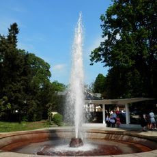
Herľany Geyser
7.9 km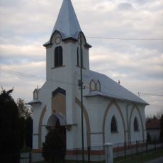
Kostol sv. Petra a Pavla
7.3 km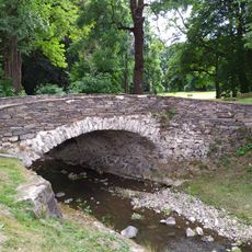
Kamenný most v Nižné Kamenici
7.6 km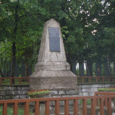
Pamätné miesto s pam. tabuľou
5 km
Bačkovská sfinga
1.3 km
Za časom na oblohe - Herliansky gejzír
7.9 km
Zapikanova chyža
5 km
Tank z II. sv. vojny
6.6 km
Lipov kameň
1.3 km
Onderkove skaly
728 m
Rebrá
2.2 km
Rebrá
2.3 km
Rebrá
2.6 km
Strechový kameň
1.1 km
T-34-85
5.4 km
SU-100
5.4 km
Anjel
5.3 km
Work of art, statue
5 km
Scenic viewpoint
3 km
Pod Holubou horou
4.1 km
Scenic viewpoint
791 m
Scenic viewpoint
3.8 km
Scenic viewpoint
1.1 km
Scenic viewpoint
6.6 km
Scenic viewpoint
6.2 km
Davidovská skala
7.3 km
Scenic viewpoint
2.9 km
Tourist attraction, frontage road
7.6 kmReviews
Visited this place? Tap the stars to rate it and share your experience / photos with the community! Try now! You can cancel it anytime.
Discover hidden gems everywhere you go!
From secret cafés to breathtaking viewpoints, skip the crowded tourist spots and find places that match your style. Our app makes it easy with voice search, smart filtering, route optimization, and insider tips from travelers worldwide. Download now for the complete mobile experience.

A unique approach to discovering new places❞
— Le Figaro
All the places worth exploring❞
— France Info
A tailor-made excursion in just a few clicks❞
— 20 Minutes