Waterfall of Hrhov
Location: Hrhov
Location: okres Rožňava
GPS coordinates: 48.60751,20.74861
Latest update: October 11, 2024 06:53
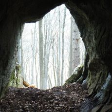
Jeskyně planiny Horný vrch
2.2 km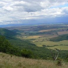
Turnianska kotlina
2.7 km
Slnečná priepasť
3.4 km
Kalvínsky kostol
137 m
Kostol sv. Jána Krstiteľa, veža
125 m
Vodný mlyn
118 m
Kostol sv. Jána Krstiteľa, fara
126 m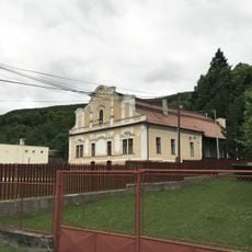
Kaštieľ
2.8 km
Rock, scenic viewpoint, rock
939 m
Scenic viewpoint
2.6 km
Scenic viewpoint
2.2 km
Scenic viewpoint
2.4 km
Scenic viewpoint
2.5 km
Scenic viewpoint
2.6 km
Scenic viewpoint
2.6 km
Scenic viewpoint
2.6 km
Scenic viewpoint
2.6 km
Scenic viewpoint
2.6 km
Scenic viewpoint
2.6 km
Holubia skala
1.6 km
Scenic viewpoint
1.4 km
Scenic viewpoint
900 m
Scenic viewpoint
2.8 km
Scenic viewpoint
2.8 km
Scenic viewpoint
2.8 km
Výhľad na Hrhov
2.9 km
Scenic viewpoint
3.1 km
Ľadovňa
362 mReviews
Visited this place? Tap the stars to rate it and share your experience / photos with the community! Try now! You can cancel it anytime.
Discover hidden gems everywhere you go!
From secret cafés to breathtaking viewpoints, skip the crowded tourist spots and find places that match your style. Our app makes it easy with voice search, smart filtering, route optimization, and insider tips from travelers worldwide. Download now for the complete mobile experience.

A unique approach to discovering new places❞
— Le Figaro
All the places worth exploring❞
— France Info
A tailor-made excursion in just a few clicks❞
— 20 Minutes