Centro BTT
Location: Melgar de Fernamental
GPS coordinates: 42.40808,-4.24852
Latest update: November 23, 2025 23:15
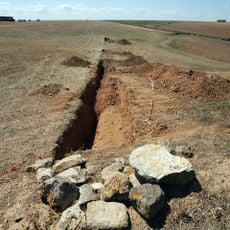
Dessobriga
6.4 km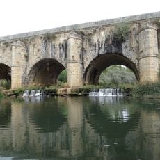
Aqueduct of Abánades
4.1 km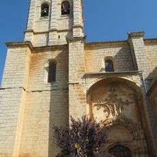
Church of Santa María de la Asunción, Melgar de Fernamental
547 m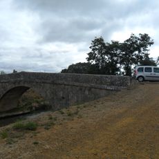
Puente de Carrecalzada
2.8 km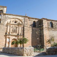
Church of Santos Juanes
6 km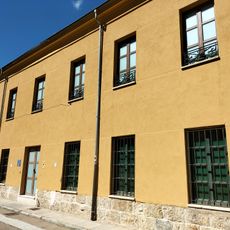
Biblioteca Pública Municipal de Osorno la Mayor - Fernando de Torres y Almunia
9.3 km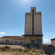
Silo de Osorno la Mayor II
8.9 km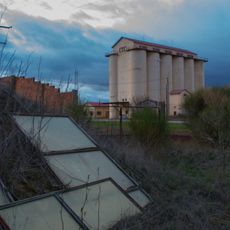
Silo of Melgar de Fernamental
838 m
Hermitage of Nuestra Señora de Zorita
2.5 km
Padre Luis Martín. S.J.
630 m
Escudo
5.9 km
Embarcadero Carrecalzada
2.6 km
Casa del Cordón
544 m
Work of art, sculpture
739 m
Soportales de San Antón
344 m
Wayside cross
5.9 km
Teófilo Ceballos
640 m
Wayside cross
5.9 km
Soportales del Antiguo Herradero
497 m
Escudo
560 m
Puente San Pedro de Ruyales
9.2 km
Casilla Peón Caminero
8.5 km
Casilla Peón Caminero
8.8 km
Escudo de Padilla de Abajo
5.8 km
Monument
348 m
Catholic church building, wayside cross
5.6 km
Waterfall
8.9 km
Waterfall
3.9 kmReviews
Visited this place? Tap the stars to rate it and share your experience / photos with the community! Try now! You can cancel it anytime.
Discover hidden gems everywhere you go!
From secret cafés to breathtaking viewpoints, skip the crowded tourist spots and find places that match your style. Our app makes it easy with voice search, smart filtering, route optimization, and insider tips from travelers worldwide. Download now for the complete mobile experience.

A unique approach to discovering new places❞
— Le Figaro
All the places worth exploring❞
— France Info
A tailor-made excursion in just a few clicks❞
— 20 Minutes