Chopo de Zumel
Location: Valle de Santibáñez
GPS coordinates: 42.44799,-3.81158
Latest update: November 2, 2025 05:25
Castillo de Ubierna
10.5 km
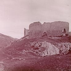
Torre de Zumel
138 m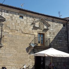
Palacio de los Tiros
10.8 km
Church of San Pedro, Miñón de Santibáñez
2.3 km
Torre de Quintanaortuño
10.4 km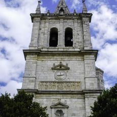
Church of San Nicolás, Santibáñez-Zarzaguda
4.3 km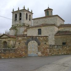
Church of Huérmeces
8.9 km
Granero de Santibáñez-Zarzaguda
4.1 km
Granero de Sotopalacios
10.8 km
Menhir Vallemedín - Piedralta - Piedra Alta
6.6 km
Sagrada Familia
4.3 km
Palacio de los Salamanca
9.2 km
Mirador Alto la Cruz
10.2 km
Menhir Las Atalayas (la Buena Moza, Las Talayas)
7.6 km
Dolmen El Corral
10.1 km
Labradores
8.9 km
Los Labriegos
4.3 km
Plegaria del Árbol
9 km
Torreón de los Padilla
8.8 km
Stele, memorial
9.7 km
Memorial
10.7 km
Memorial
10.3 km
Memorial
10.2 km
Andrés Díaz de Venero y Leyva
7.1 km
Segador
4.4 km
Sagrado Corazón de Jesús
4.3 km
Cruz a los caídos en la Guerra Civil
10.4 km
Memorial
10.6 kmReviews
Visited this place? Tap the stars to rate it and share your experience / photos with the community! Try now! You can cancel it anytime.
Discover hidden gems everywhere you go!
From secret cafés to breathtaking viewpoints, skip the crowded tourist spots and find places that match your style. Our app makes it easy with voice search, smart filtering, route optimization, and insider tips from travelers worldwide. Download now for the complete mobile experience.

A unique approach to discovering new places❞
— Le Figaro
All the places worth exploring❞
— France Info
A tailor-made excursion in just a few clicks❞
— 20 Minutes