Société de tir St-Sébastien, stand 300m 50m 25m
Location: Finhaut
Address: Route du Stand 1925 1925
GPS coordinates: 46.08730,6.98115
Latest update: November 9, 2025 13:53
Fontanabran
3.6 km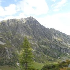
Luisin
3.8 km
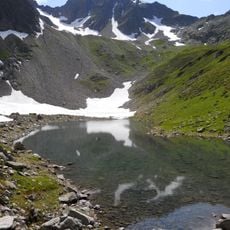
Mont de l'Arpille
2.3 km
Bel Oiseau
3.5 km
La Rebarme
1.9 km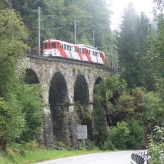
Viaduc de la Scierie
622 m
Tête Carrée
2.4 km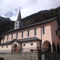
Assumption of Mary church
764 m
Mont de la Barme
1.7 km
Saint-Bernard church
3.6 km
Dent d'Emaney
2.5 km
Dent de Fenestral
2.4 km
Fort Finhaut
3.9 km
The three bridges
2.3 km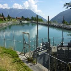
Accumulation basin SFR
3.1 km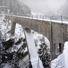
Châtelard aqueduct
3.5 km
Gorges du Triège
2.3 km
Grotte aux Nymphes
1.5 km
Gorges mystérieuses de Tête Noire
1.5 km
Itre
2.6 km
Statue, Work of art
4.1 km
Scenic viewpoint
3.5 km
Scenic viewpoint
2.3 km
Scenic viewpoint
3.2 km
Scenic viewpoint
3 km
Scenic viewpoint
1.7 km
Scenic viewpoint
3.3 km
Scenic viewpoint
2.2 kmReviews
Visited this place? Tap the stars to rate it and share your experience / photos with the community! Try now! You can cancel it anytime.
Discover hidden gems everywhere you go!
From secret cafés to breathtaking viewpoints, skip the crowded tourist spots and find places that match your style. Our app makes it easy with voice search, smart filtering, route optimization, and insider tips from travelers worldwide. Download now for the complete mobile experience.

A unique approach to discovering new places❞
— Le Figaro
All the places worth exploring❞
— France Info
A tailor-made excursion in just a few clicks❞
— 20 Minutes