Grande ronde de Mansonville
Location: Potton
Address: 25 25 Rue Joseph-Blanchet Potton Potton
GPS coordinates: 45.05306,-72.39385
Latest update: November 22, 2025 06:33
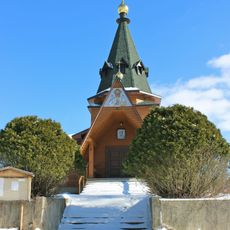
Holy Transfiguration skete
4.7 km
Réserve naturelle des Montagnes-Vertes
9.7 km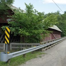
Pont de la Frontière
4.9 km
Vallée-du-Ruiter Ecological Reserve
5.9 km
Pont Tibbits
8.9 km
Parc de la rivière Missisquoi Nord
628 m
Pont Eastman
8.7 km
Pont Burnett
10.1 km
Pont Brock
8.4 km
Réserve naturelle de l'Île-Longue
10 km
Mont Sugar Loaf
8.8 km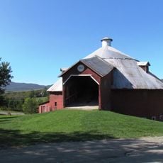
Grange ronde de Mansonville
94 m
Réserve naturelle Tyre-Macfarlane
9.9 km
Start-End Trail
7.9 km
Pv Passe du Diable
10 km
Plage de Mansonville
8.9 km
Work of art
4.2 km
Pv sur les collines
2.9 km
Pv Écho 2
9.6 km
Pv Écho 1
9.7 km
Club de golf Owl's Head
6.2 km
Scenic viewpoint
4.9 km
Scenic viewpoint
7.4 km
Scenic viewpoint
7.5 km
Scenic viewpoint
7.6 km
Scenic viewpoint
8.9 km
Chutes de Mansonville
470 m
Chutes de mansonville
474 mReviews
Visited this place? Tap the stars to rate it and share your experience / photos with the community! Try now! You can cancel it anytime.
Discover hidden gems everywhere you go!
From secret cafés to breathtaking viewpoints, skip the crowded tourist spots and find places that match your style. Our app makes it easy with voice search, smart filtering, route optimization, and insider tips from travelers worldwide. Download now for the complete mobile experience.

A unique approach to discovering new places❞
— Le Figaro
All the places worth exploring❞
— France Info
A tailor-made excursion in just a few clicks❞
— 20 Minutes