Vermillion Arch
Location: Coconino County
GPS coordinates: 36.80778,-112.05694
Latest update: November 24, 2025 04:36

Lookout trees in Kaibab National Forest
15.9 km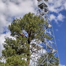
Jacob Lake Lookout Tower
18.4 km
Cooper Ridge Lookout Tree
15.9 km
Rock Canyon Reservoir
12.6 km
Pile of Pancakes
18.3 km
Postman
17.7 km
Double Barrel Arch
5.4 km
Sunset Butte
14.7 km
Wired Rocks
18.3 km
Rock Stripes
18 km
Camelback Rocks
7.3 km
Chess Queen
18.5 km
Colourful Rocks
6.7 km
Cottonwood Cove
17.5 km
Paw Hole Teepees
13.5 km
Cottonwood Teepees
18.1 km
Poverty Flat Ranch
15.4 km
Teepees
17.5 km
World Cup
17.6 km
Ancient Pathway Monument
18.1 km
Old Corral
6 km
Southern Wave
18.5 km
Red Cave
18.4 km
Jacob Lake Lookout Tower
18.4 km
Lookout Vermillion Cliffs
9.1 km
Scenic View Vermillion Cliffs
9.5 km
Le Fevre Overlook
17.8 km
Cottenwood Teepees Viewpoint
16.5 kmReviews
Visited this place? Tap the stars to rate it and share your experience / photos with the community! Try now! You can cancel it anytime.
Discover hidden gems everywhere you go!
From secret cafés to breathtaking viewpoints, skip the crowded tourist spots and find places that match your style. Our app makes it easy with voice search, smart filtering, route optimization, and insider tips from travelers worldwide. Download now for the complete mobile experience.

A unique approach to discovering new places❞
— Le Figaro
All the places worth exploring❞
— France Info
A tailor-made excursion in just a few clicks❞
— 20 Minutes