Feuer- und Lichtobjekte
Website: https://www.feuer-licht.de/
Website: https://feuer-licht.de
GPS coordinates: 51.75409,6.89235
Latest update: November 29, 2024 00:21
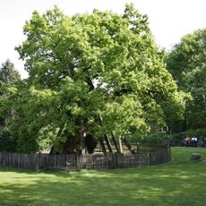
Femeiche
2.3 km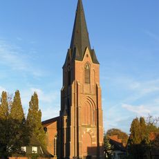
St. Silvester
2.1 km
St. Urbanus (Rhade)
2.6 km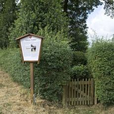
Jewish cemetery, Raesfeld-Erle
2.3 km
Rhader Wiesen
3.1 km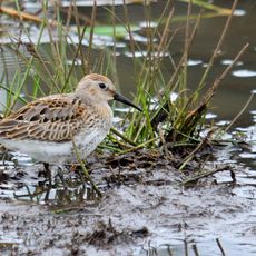
Üfter-, Rüster- und Emmelkämper Mark
3.2 km
Jüdische Friedhöfe
3.6 km
LSG-Rhader Hoefe
2.8 km
Haart-Venn
2.5 km
LSG-Raesfeld / Homer / Erle / Westrich / Oestrich
1.5 km
Rhader Wiesen
1.1 km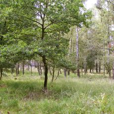
Üfter Mark
1.8 km
Wayside cross
1.8 km
Wayside cross
1.4 km
Christianity, wayside shrine
2.4 km
Catholic church building, wayside shrine, Christianity
2.5 km
Wayside cross
2.5 km
Pietà
2.3 km
Rhader Geschichtstafeln: Schützenstraße - Die Fliehburg Hoß Kalverkamp
2.6 km
Wegkapelle
2.7 km
Wayside shrine, Christianity
1.7 km
Hochkreuz
2.4 km
Denkmal 500 Jahre Rhade
1.3 km
Storchennest
3.4 km
Wildbeobachtungsplattform
3.4 km
Wayside cross
689 m
Wayside cross
3.7 km
Christianity, Catholic church building, wayside shrine
3.7 kmReviews
Visited this place? Tap the stars to rate it and share your experience / photos with the community! Try now! You can cancel it anytime.
Discover hidden gems everywhere you go!
From secret cafés to breathtaking viewpoints, skip the crowded tourist spots and find places that match your style. Our app makes it easy with voice search, smart filtering, route optimization, and insider tips from travelers worldwide. Download now for the complete mobile experience.

A unique approach to discovering new places❞
— Le Figaro
All the places worth exploring❞
— France Info
A tailor-made excursion in just a few clicks❞
— 20 Minutes