Plage du Bassin Dombret
Location: Les Sables-d'Olonne
GPS coordinates: 46.48918,-1.80142
Latest update: November 13, 2025 08:46
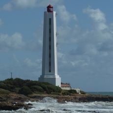
L'Armendèche lighthouse
266 m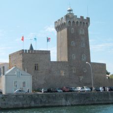
Château Saint-Clair
671 m
Parc de la Villa Charlotte
558 m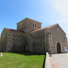
Chapelle du prieuré Saint-Nicolas des Sables-d'Olonne
525 m
Scenic viewpoint
540 m
Scenic viewpoint
667 m
Phare de la Chaume
680 m
Le Phare Boréal
641 m
Work of art
266 m
Work of art, sculpture
32 m
Work of art, sculpture
28 m
Sculpture, Work of art
24 m
Work of art, sculpture
21 m
Work of art, sculpture
551 m
Mémorial des Péris en mer
553 m
Cannon
470 m
Cannon
472 m
Cannon
474 m
Cannon
478 m
Cannon
482 m
Cannon
500 m
Cannon
504 m
Cannon
507 m
Cannon
511 m
Cannon
514 m
Cannon
536 m
Cannon
539 m
Wayside cross
373 mReviews
Visited this place? Tap the stars to rate it and share your experience / photos with the community! Try now! You can cancel it anytime.
Discover hidden gems everywhere you go!
From secret cafés to breathtaking viewpoints, skip the crowded tourist spots and find places that match your style. Our app makes it easy with voice search, smart filtering, route optimization, and insider tips from travelers worldwide. Download now for the complete mobile experience.

A unique approach to discovering new places❞
— Le Figaro
All the places worth exploring❞
— France Info
A tailor-made excursion in just a few clicks❞
— 20 Minutes