Grey River
Location: Wongarra
Location: Shire of Colac Otway
GPS coordinates: -38.68437,143.83981
Latest update: November 21, 2025 03:15

Sabine Falls
10.2 km
Biddles Beach
10.3 km
Mount Sabine
11.7 km
Mount Defiance
13.5 km
Mount Meuron
1.3 km
Henry's Tramway Tunnel
13.2 km
Gentle Annie Hill
11.2 km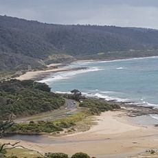
Kennett River
2.6 km
Pine Ridge Hill
9.6 km
Cape Patton Lookout
1.2 km
Scenic viewpoint
7.6 km
Carisbrook Creek
2.9 km
White Crest
5.6 km
W.B. Godfrey Wreck
10.9 km
Sabine falls
10.3 km
Scenic viewpoint
11.8 km
Carisbrook Falls Lookout
2.6 km
Scenic viewpoint
7.5 km
Godfrey Creek
10.7 km
Glowflies (at night)
3.5 km
Captain Godfrey Grave
10.9 km
Wye River Falls
8 km
Brunswick Falls
11.8 km
Allambee Beek Falls
10.8 km
Staircase Falls
10.9 km
Hidden Falls
10.4 km
Amphitheatre Falls
11 km
Galliebarinda Falls
11.6 kmReviews
Visited this place? Tap the stars to rate it and share your experience / photos with the community! Try now! You can cancel it anytime.
Discover hidden gems everywhere you go!
From secret cafés to breathtaking viewpoints, skip the crowded tourist spots and find places that match your style. Our app makes it easy with voice search, smart filtering, route optimization, and insider tips from travelers worldwide. Download now for the complete mobile experience.

A unique approach to discovering new places❞
— Le Figaro
All the places worth exploring❞
— France Info
A tailor-made excursion in just a few clicks❞
— 20 Minutes