Plage de Kerbilouet
Location: France métropolitaine
GPS coordinates: 47.62242,-2.81130
Latest update: November 17, 2025 10:08

Manoir de Kérat
1 km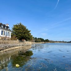
Plage de Kerbilouet
13 m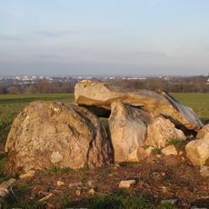
Dolmen de Kerhenry
1.4 km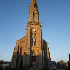
Église Saint-Pierre d'Arradon
1 km
Villa romaine du Lodo
411 m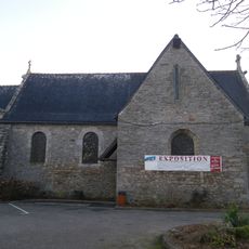
Église Saint-Pierre dite chapelle du bourg d'Arradon
991 m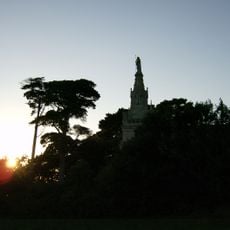
Chapelle Saint-Joseph de Penboc'h
744 m
Croix de chemin
541 m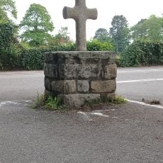
Croix de Truhelin
492 m
Le Vachteuil
190 m
Scenic viewpoint
1.5 km
Scenic viewpoint
1.4 km
Plage de la carrière
1.4 km
Dolmen de Ker Henry
1.4 km
Plage de Penboch
582 m
Crique
951 m
Galerie de la Baie
993 m
Statue de la Vierge Marie
677 m
Scenic viewpoint
903 m
Anse Jeannine
164 m
Archaeological site, menhir
529 m
Archaeological site, private road
532 m
Résistance 1944
716 m
Wayside cross
1 km
Memorial, war memorial
1 km
Christianity, Catholic church building, wayside cross
1.4 km
Ici Ont Été Fusillés
716 m
Wayside cross
905 mReviews
Visited this place? Tap the stars to rate it and share your experience / photos with the community! Try now! You can cancel it anytime.
Discover hidden gems everywhere you go!
From secret cafés to breathtaking viewpoints, skip the crowded tourist spots and find places that match your style. Our app makes it easy with voice search, smart filtering, route optimization, and insider tips from travelers worldwide. Download now for the complete mobile experience.

A unique approach to discovering new places❞
— Le Figaro
All the places worth exploring❞
— France Info
A tailor-made excursion in just a few clicks❞
— 20 Minutes