Indian Camp Campground
Location: Kittitas County
GPS coordinates: 47.28953,-120.95239
Latest update: November 21, 2025 18:06
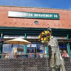
Northwestern Improvement Company Store
7.9 km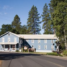
Milwaukee Road Bunkhouse
11.9 km
Ensign Ranch Water Slide
13.8 km
Teanaway Valley Wildlife Area
11.1 km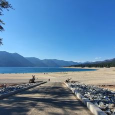
Speelyi Beach
9.9 km
Loggers Field
11.1 km
Malcolm Mountain
9.1 km
Jolly Mountain
11.7 km
Sasse Mountain
10.9 km
China Point
17.3 km
Yellow Hill
5 km
Little Salmon la Sac
15.1 km
KBHR Set
8 km
Work of art, sculpture
8.2 km
Tumble Creek Golf Course
10.8 km
Hex Mountain Trailhead
11 km
Rope Rider Golf Course
9.6 km
Prospector Golf Course
10.2 km
Work of art
15.9 km
Sun Country Golf & RV Park
13.6 km
Scenic viewpoint
14.3 km
Scenic viewpoint, parking lot
12.4 km
Scenic viewpoint
12.5 km
Scenic viewpoint
16.2 km
Scenic viewpoint
12 km
Scenic viewpoint
12.3 km
Scenic viewpoint
11.6 km
Railway carriage
13.3 kmReviews
Visited this place? Tap the stars to rate it and share your experience / photos with the community! Try now! You can cancel it anytime.
Discover hidden gems everywhere you go!
From secret cafés to breathtaking viewpoints, skip the crowded tourist spots and find places that match your style. Our app makes it easy with voice search, smart filtering, route optimization, and insider tips from travelers worldwide. Download now for the complete mobile experience.

A unique approach to discovering new places❞
— Le Figaro
All the places worth exploring❞
— France Info
A tailor-made excursion in just a few clicks❞
— 20 Minutes