Enable Location

We need your location to show you interesting places around you

Discover nearby places

Find interesting locations and hidden gems around you

Precise directions

Get accurate directions and distances to places

Your location is never shared with other users. It's only used when you tap the location button.

Kittitas County

Log in to your account

Start exploring — it's free

Trusted by 61,526 travelers worldwide

Continue with Google
Continue with Apple
or

We will send you a code to connect

By continuing, you accept our Terms and Conditions and our Privacy Policy

Check your inbox

We've sent a pincode in your inbox. Please enter the code below.

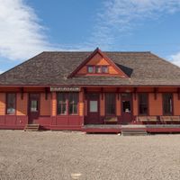
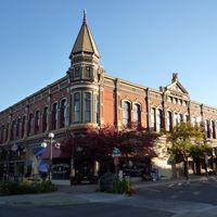
Kittitas County, County administration center in Ellensburg, Washington, US

Description

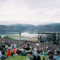
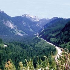
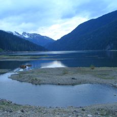
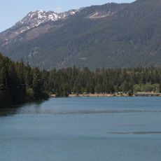
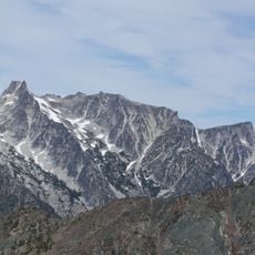
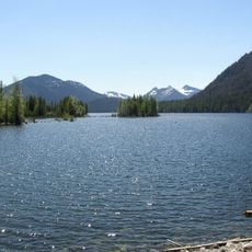
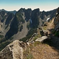
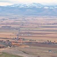
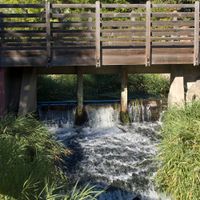
Kittitas County is an administrative region in Washington that stretches from the Cascade Mountains to the Columbia River. The area contains mountainous terrain, valleys, and flatlands with different natural features throughout.

History

The Washington Territorial Legislature created Kittitas County in November 1883 by separating it from Yakima County. This split allowed the area to develop its own governance and local institutions.

Culture

The Kittitas Valley served as a gathering place for Native American tribes before European settlement changed the landscape. Today, ranching and farming traditions shape how residents connect with the land.

Practical

The County Courthouse in Ellensburg is the main location for administrative services and is generally open Monday through Friday. Visitors should be aware that hours and available services may change on holidays and special days.

Did you know?

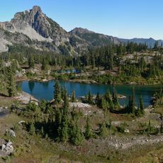
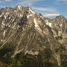
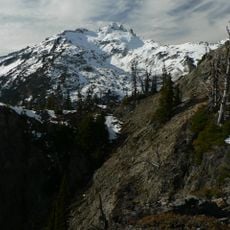
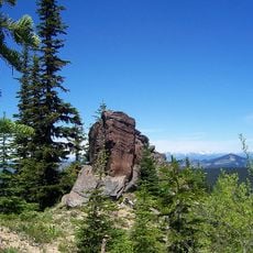
Mount Daniel at about 7,900 feet is the highest peak in the county and offers views of both farming valleys and mountain terrain. This location shows the geographic variety that defines the entire area.

Location
Inception
1883
Capital city
Ellensburg
Shares border with
Chelan County, Douglas County, Grant County, Yakima County, Pierce County, King County
GPS coordinates
47.12000,-120.68000
Latest update
December 20, 2025 14:19

AroundUs brings together thousands of curated places, local tips, and hidden gems, enriched daily by 60,000 contributors worldwide. Discover all places nearby (Washington).

Around this place
The Gorge Amphitheatre
United States of America

The Gorge Amphitheatre

51.9 km
Snoqualmie Pass
United States of America

Snoqualmie Pass

63.6 km
Alpine Lakes Wilderness
United States of America

Alpine Lakes Wilderness

62 km
Ginkgo Petrified Forest State Park
United States of America

Ginkgo Petrified Forest State Park

54.8 km
Stampede Pass
United States of America

Stampede Pass

53.9 km
Mount Stuart
United States of America

Mount Stuart

42.9 km
Kachess Lake
United States of America

Kachess Lake

46.7 km
United States of America

Keechelus Lake

57.9 km
Franklin Falls
United States of America

Franklin Falls

66.2 km
Iron Horse State Park
United States of America

Iron Horse State Park

43.9 km
Grandfather Cuts Loose the Ponies
United States of America

Grandfather Cuts Loose the Ponies

57.1 km
Wanapum Dam
United States of America

Wanapum Dam

60.3 km
Wild Horse Wind and Solar Facility
United States of America

Wild Horse Wind and Solar Facility

37 km
Rock Island Dam
United States of America

Rock Island Dam

50.7 km
Lincoln Rock State Park
United States of America

Lincoln Rock State Park

51.6 km
Whiskey Dick Mountain
United States of America

Whiskey Dick Mountain

35.6 km
Mount Daniel
United States of America

Mount Daniel

62.3 km
Lake Easton State Park
United States of America

Lake Easton State Park

42.2 km
Vantage Bridge
United States of America

Vantage Bridge

57.6 km
United States of America

Mountains to Sound Greenway

62 km
United States of America

Manastash Ridge Observatory

19.1 km
Dragontail Peak
United States of America

Dragontail Peak

41.6 km
William O. Douglas Wilderness
United States of America

William O. Douglas Wilderness

59.6 km
Bumping Lake
United States of America

Bumping Lake

57 km
Kendall Katwalk
United States of America

Kendall Katwalk

64.4 km
Columbia River Bridge
United States of America

Columbia River Bridge

43.6 km
Norse Peak Wilderness
United States of America

Norse Peak Wilderness

61.4 km
Olmstead Place State Park
United States of America

Olmstead Place State Park

22.9 km
Show the full map
« Kittitas County - County administration center in Ellensburg, Washington, US » is provided by Around Us (aroundus.com). Images and texts are derived from Wikimedia project under a Creative Commons license. You are allowed to copy, distribute, and modify copies of this page, under the conditions set by the license, as long as this note is clearly visible.

Discover hidden gems everywhere you go!

From secret cafés to breathtaking viewpoints, skip the crowded tourist spots and find places that match your style. Our app makes it easy with voice search, smart filtering, route optimization, and insider tips from travelers worldwide. Download now for the complete mobile experience.

Around Us App Screenshot

A unique approach to discovering new places

Le Figaro

All the places worth exploring

France Info

A tailor-made excursion in just a few clicks

20 Minutes

Around Us
Travel Guide & Maps
Download

Send to your phone

QR Code
1

Open the camera app on your mobile.

2

Point at the QR code with your camera. A notification will appear.

3

Tap the notification to open the link.