Танк
Location: Верхошижемское городское поселение
GPS coordinates: 58.01058,49.10456
Latest update: October 27, 2025 19:08
Заповедник "Нургуш"
38.2 km
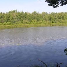
Orlovskoye Lake
38.3 km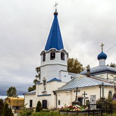
Church of the Protection of the Theotokos, Sovetsk
46.7 km
Советский районный краеведческий музей
47.1 km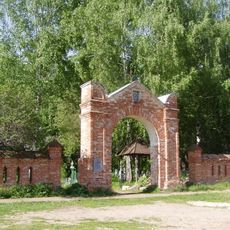
Pokrovskoye Cemetery
46.8 km
Scenic viewpoint
41.6 km
Memorial
42.6 km
Зайцы
43.2 km
Кабан
43.1 km
Логово Йети
44 km
Лисица
43.1 km
Белка
43.1 km
340 лет Верхошижемье
2.8 km
Пижемское городище
44.6 km
Королевская ель
15.6 km
Scenic viewpoint
37.4 km
Быковское
38.2 km
Memorial
47.1 km
Memorial, war memorial
91 m
Memorial
46.9 km
Воинам-землякам, погибшим в боях за Родину 1941-1945
34.3 km
Memorial
43.1 km
Памятник героям ВОВ
37.3 km
Memorial
43.1 km
Memorial
44.1 km
Memorial, war memorial
45 km
Memorial
33.7 km
Memorial
39.2 kmReviews
Visited this place? Tap the stars to rate it and share your experience / photos with the community! Try now! You can cancel it anytime.
Discover hidden gems everywhere you go!
From secret cafés to breathtaking viewpoints, skip the crowded tourist spots and find places that match your style. Our app makes it easy with voice search, smart filtering, route optimization, and insider tips from travelers worldwide. Download now for the complete mobile experience.

A unique approach to discovering new places❞
— Le Figaro
All the places worth exploring❞
— France Info
A tailor-made excursion in just a few clicks❞
— 20 Minutes