Aboriginal
Location: Nitmiluk
Location: Roper Gulf Region
GPS coordinates: -14.31117,132.44967
Latest update: July 20, 2025 13:36
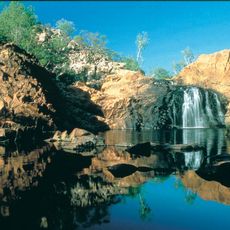
Nitmiluk National Park
22.1 km
The Katherine Museum
24.1 km
Katherine Gorge National Park
12.6 km
Jukes Park
24.6 km
Roney Park
24.2 km
Katherine Gorge
12.6 km
Donkey Camp Weir
18.1 km
Archaeological site
9.9 km
Crystal Falls
16.2 km
Scenic viewpoint
2.6 km
Biddlecombe Cascades
6.8 km
Waterfall
7 km
Waterfall
7.1 km
Lilly Pond Falls
2.5 km
Archaeological site
10 km
Work of art
2.3 km
Scenic viewpoint
1.3 km
Crystal Falls
16.1 km
Baruwei Lookout
2.5 km
Butterfly Gorge
961 m
Top Didj
20.6 km
The Ampitheatre
21.1 km
Waterfall
702 m
17 Mile Falls
22.9 km
17 Mile Falls
23.1 km
Knotts Crossing
23.3 km
Southern Rockhole
560 m
Pat's Lookout
536 mReviews
Visited this place? Tap the stars to rate it and share your experience / photos with the community! Try now! You can cancel it anytime.
Discover hidden gems everywhere you go!
From secret cafés to breathtaking viewpoints, skip the crowded tourist spots and find places that match your style. Our app makes it easy with voice search, smart filtering, route optimization, and insider tips from travelers worldwide. Download now for the complete mobile experience.

A unique approach to discovering new places❞
— Le Figaro
All the places worth exploring❞
— France Info
A tailor-made excursion in just a few clicks❞
— 20 Minutes