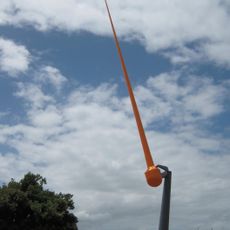
Ākau Tangi
Location: Wellington City
Creator: Phil Dadson
Creator: Phil Dadson
GPS coordinates: -41.31503,174.80072
Latest update: July 20, 2025 13:44
Zephyrometer
494 m
Ruth Gotlieb Library
517 m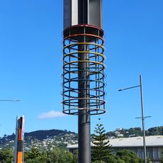
Tower of Light
355 m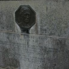
Truby King Mausoleum
1.1 km
Karitane Products Society Building (Former)
1.2 km
Truby King Historic Area
1.2 km
Truby King House
1.1 km
House
541 m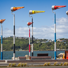
Akau Tangi
11 m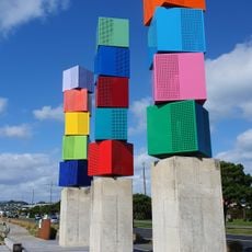
Urban Forest
241 m
Urban Forest
238 m
Ākau Tangi
8 m
Urban Forest
233 m
Ākau Tangi
53 m
Ākau Tangi
40 m
Ākau Tangi
27 m
Tower of Light
362 m
Ākau Tangi
25 m
Ākau Tangi
18 m
Urban Forest
227 m
Scenic viewpoint
599 m
Pacific Grass
738 m
Kilbirnie School War Memorial
1 km
19th NZ Infantry Battalion and 19th NZ Armoured Regiment
1 km
Work of art, sculpture
1 km
Ākau Tangi
8 m
Ākau Tangi
5 m
Ākau Tangi
5 mReviews
Visited this place? Tap the stars to rate it and share your experience / photos with the community! Try now! You can cancel it anytime.
Discover hidden gems everywhere you go!
From secret cafés to breathtaking viewpoints, skip the crowded tourist spots and find places that match your style. Our app makes it easy with voice search, smart filtering, route optimization, and insider tips from travelers worldwide. Download now for the complete mobile experience.

A unique approach to discovering new places❞
— Le Figaro
All the places worth exploring❞
— France Info
A tailor-made excursion in just a few clicks❞
— 20 Minutes