Heiliger Stefanus
Location: Jeging
Inception: January 1, 1966
GPS coordinates: 48.04760,13.14922
Latest update: November 18, 2025 00:25
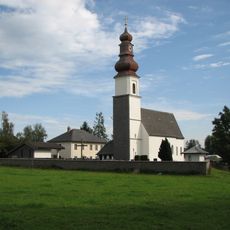
Pfarrkirche hl. Stephan, Jeging
104 m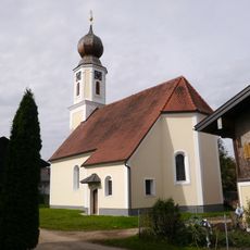
Kath. Filialkirche hl. Martin und ehem. Friedhof
2.1 km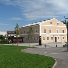
Ehem. Pfarrhof, Gemeindeamt
337 m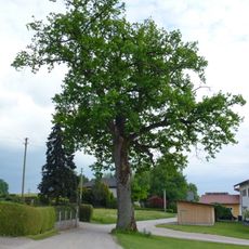
Stieleiche in Pfaffstätt
2.8 km
Heimathaus Jeging
400 m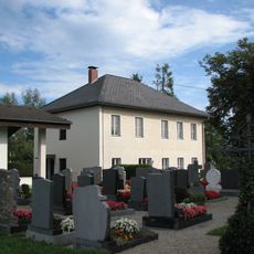
Pfarrhof
105 m
Hauseiche in Abern
842 m
Josef Steiner
2 km
Wayside shrine
905 m
Christianity, Catholic church building, wayside cross
761 m
Wayside shrine
1.9 km
Kreuz aus Gusseisen auf Sockel montiert
1.5 km
Johann Kobler
2.2 km
Wetterkreuz
1.6 km
Christianity, Catholic church building, wayside cross
2.5 km
Pestkreuz
2.1 km
Höfer Marterl
686 m
Pestkreuz
2 km
Wayside cross, Christianity, Catholic church building
1.9 km
Holzkreuz mit Rückwand und Schindeldach; Kleine Jesusfigur
950 m
Bernroider Wetterkreuz
1.3 km
Friedensbaum
268 m
Mödlhammer Mühle
1.8 km
Ludwig Falch
2.5 km
Taferlbuche
2.4 km
Anton Stockhammer
2 km
Catholic church building, wayside cross, Christianity
1.9 km
Wayside cross
2.5 kmReviews
Visited this place? Tap the stars to rate it and share your experience / photos with the community! Try now! You can cancel it anytime.
Discover hidden gems everywhere you go!
From secret cafés to breathtaking viewpoints, skip the crowded tourist spots and find places that match your style. Our app makes it easy with voice search, smart filtering, route optimization, and insider tips from travelers worldwide. Download now for the complete mobile experience.

A unique approach to discovering new places❞
— Le Figaro
All the places worth exploring❞
— France Info
A tailor-made excursion in just a few clicks❞
— 20 Minutes