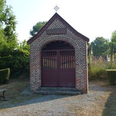
Douanier assis
Location: Rumegies
Inception: January 1, 2007
Creator: Dupon Erik
Creator: Dupon Erik
GPS coordinates: 50.49341,3.37118
Latest update: November 12, 2025 16:38
Chapelle Notre-Dame-de-Grâce de Saméon
3.6 km
Église Saint-Aybert
3.8 km
Église Saint-Denis de Lecelles
3 km
Église Saint-Nicolas de Rosult
3.8 km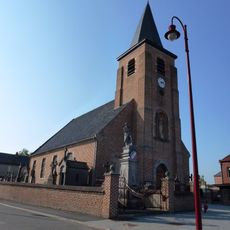
Église Saint-Martin de Saméon
3.2 km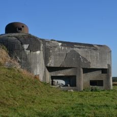
Fort De Maulde
4.1 km
Église Saint-Brice de Rumegies
1.7 km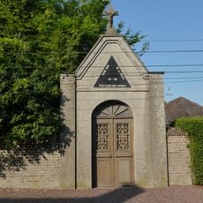
Chapelle Notre-Dame-de-la-Treille de Saméon
4 km
Ossuaire
3.3 km
Columbarium
3.3 km
Wayside shrine
3.1 km
Calvaire
1.9 km
Monument aux morts 1914-1918
2 km
Wayside shrine, Christianity, Catholic church building
1.8 km
La Brigade Piron
1.6 km
Columbarium
3.3 km
Anciens combattants
3.3 km
Wayside cross
3.3 km
Chapelle des Affligés
2.6 km
Chapelle Notre-Dame De La Treille
4 km
Monument aux morts 1914-1918
3 km
Rumegies à ses Morts.
1.7 km
Capsule temporelle 16-10-2020 16-10-2050
3.1 km
Monument aux Morts de Rosult
3.8 km
Monument aux Morts de Rosult
3.8 km
Wayside cross
3.3 km
House of prayer, place of worship, wayside shrine, Christianity
1.7 km
Wayside shrine
2.1 kmReviews
Visited this place? Tap the stars to rate it and share your experience / photos with the community! Try now! You can cancel it anytime.
Discover hidden gems everywhere you go!
From secret cafés to breathtaking viewpoints, skip the crowded tourist spots and find places that match your style. Our app makes it easy with voice search, smart filtering, route optimization, and insider tips from travelers worldwide. Download now for the complete mobile experience.

A unique approach to discovering new places❞
— Le Figaro
All the places worth exploring❞
— France Info
A tailor-made excursion in just a few clicks❞
— 20 Minutes