Élévation
Location: Woluwe-Saint-Lambert - Sint-Lambrechts-Woluwe
Creator: Jean-François Lecomte
GPS coordinates: 50.84746,4.45053
Latest update: November 14, 2025 23:14
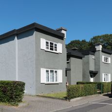
Kapelleveld
289 m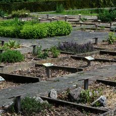
Tuin van Geneeskrachtige planten
471 m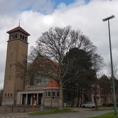
Our Lady of the Assumption Church
76 m
Beeldentuin
430 m
Chemin des Buttes
324 m
Chemin de Flore
469 m
Chemin des Pharmaciens
528 m
Montée de l'Esplanade
536 m
Chemin des Buissons
338 m
Chemin de la Mule
331 m
Le Raccourci
413 m
Chemin de l'Idéal - Ideaalpad
377 m
Le Mur
519 m
Timetable
523 m
Autoportrait
490 m
Sans titre
520 m
Vent
509 m
À mon Père
476 m
Faille de Schiste
485 m
L'Être
481 m
La Conquista
458 m
Mudra
515 m
L'Oiseau bleu
500 m
L'Allégorie de la médecine traditionnelle
251 m
Me and my pal
51 m
Catholic church building, wayside shrine, Christianity
44 m
Louis Pasteur
508 m
André Vésale
509 mReviews
Visited this place? Tap the stars to rate it and share your experience / photos with the community! Try now! You can cancel it anytime.
Discover hidden gems everywhere you go!
From secret cafés to breathtaking viewpoints, skip the crowded tourist spots and find places that match your style. Our app makes it easy with voice search, smart filtering, route optimization, and insider tips from travelers worldwide. Download now for the complete mobile experience.

A unique approach to discovering new places❞
— Le Figaro
All the places worth exploring❞
— France Info
A tailor-made excursion in just a few clicks❞
— 20 Minutes