Svatý obrázek
Location: Blatnice pod Svatým Antonínkem
GPS coordinates: 48.95202,17.46418
Latest update: November 16, 2025 07:41
St. Anthony's Hill
1.2 km
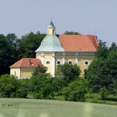
Church of Saint Andrew
606 m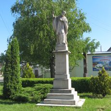
Socha svatého Františka Xaverského
765 m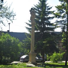
Maria column in Blatnice pod Svatým Antonínkem
547 m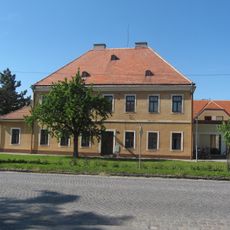
Fara
628 m
Wayside shrine, Christianity
1.1 km
Christianity, wayside shrine
1.1 km
Statue, Work of art
912 m
Work of art, statue
871 m
Wayside cross, Christianity
434 m
Wayside cross, Christianity
925 m
Wayside shrine, Christianity
1.1 km
Christianity, wayside shrine
1.1 km
Wayside shrine, Christianity
1.1 km
Sv. Jan Nepomucký
670 m
Wayside shrine, Christianity
1.1 km
Statue, Work of art
1.1 km
Wayside shrine, Christianity
1.1 km
Christianity, wayside shrine
1.1 km
Wayside shrine, Christianity
1.1 km
Wayside shrine, Christianity
1.2 km
Wayside shrine, Christianity
1.1 km
Wayside shrine, Christianity
1.2 km
Wayside shrine, Christianity
1.2 km
Pomník obětem 1. sv. války
607 m
Pamětní deska obětem 2. sv. války
614 m
Wayside cross, Christianity
181 m
Wayside cross, Christianity
1.1 kmReviews
Visited this place? Tap the stars to rate it and share your experience / photos with the community! Try now! You can cancel it anytime.
Discover hidden gems everywhere you go!
From secret cafés to breathtaking viewpoints, skip the crowded tourist spots and find places that match your style. Our app makes it easy with voice search, smart filtering, route optimization, and insider tips from travelers worldwide. Download now for the complete mobile experience.

A unique approach to discovering new places❞
— Le Figaro
All the places worth exploring❞
— France Info
A tailor-made excursion in just a few clicks❞
— 20 Minutes