Vesipyörä
Location: Mynämäki
Creator: Teo Mero, Niko Hiltunen, Jussi Kukkola, Pasi Lähteinen
Creator: Teo Mero, Niko Hiltunen, Jussi Kukkola, Pasi Lähteinen
GPS coordinates: 60.68108,21.98783
Latest update: July 20, 2025 14:45
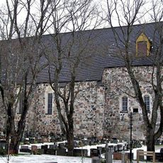
Mynämäki Church
237 m
Hautausmaa
224 m
Ylätie 7
1.2 km
Mäki (ent. Impon Riihimäki)
980 m
Karkkismäki
3.7 km
Kivikoski
1.4 km
Kallavuori
3.8 km
Pahikkalanmäki
1.2 km
Mäntyharju
1.4 km
Otikan mäki
526 m
Nihattula
148 m
Heimola 2
1 km
Nihattulanpuolenpelto 2
836 m
Franttilannummi - Junttilannummi
844 m
Myllymäki (Keijainen, Vänni)
973 m
Myllymäki
1.3 km
Kankare
1.3 km
Katajisto
1.3 km
Pukkilan pelto
517 m
Marekivi
308 m
Veteraanikivi
428 m
Mynämäen tulipalo 1933
572 m
Evakkokivi
577 m
Antti Lizelius's memorial statue
300 m
Ajan kiertokampi
3.4 km
Johan Gadolinin muistokivi
296 m
Kallavuori-3
3.8 km
Sankaripatsas
232 mReviews
Visited this place? Tap the stars to rate it and share your experience / photos with the community! Try now! You can cancel it anytime.
Discover hidden gems everywhere you go!
From secret cafés to breathtaking viewpoints, skip the crowded tourist spots and find places that match your style. Our app makes it easy with voice search, smart filtering, route optimization, and insider tips from travelers worldwide. Download now for the complete mobile experience.

A unique approach to discovering new places❞
— Le Figaro
All the places worth exploring❞
— France Info
A tailor-made excursion in just a few clicks❞
— 20 Minutes