Route du Patois
Location: Rebreuve-Ranchicourt
Creator: Sérusier
Creator: Sérusier
GPS coordinates: 50.43745,2.55900
Latest update: November 14, 2025 02:30
Parc d'Olhain
1.2 km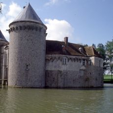
Château d'Olhain
2.3 km
Arboretum d'Olhain
1.2 km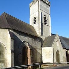
Église Saint-Jean-Baptiste
2.2 km
Église Saint-Léger d'Hermin
2.1 km
Église Saint-Sébastien de Maisnil-lès-Ruitz
2.6 km
Terril n°3 (6 de Bruay Ouest)
2.5 km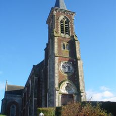
Église Notre-Dame de Rebreuve-Ranchicourt
242 m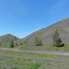
Spoil tips 2 and 3
2.6 km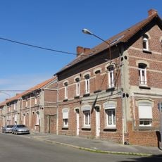
Cités de la Victoire et des Arbres
2.4 km
Scenic viewpoint
2 km
Plate-forme panoramique
2.7 km
Route du Patois
2.5 km
Route du Patois
2.3 km
Luge 4 Saisons
1.9 km
Route du Patois
1.8 km
Route du Patois
1.9 km
Route du Patois
2.1 km
Route du Patois
2.3 km
Route du Patois
2.4 km
Statue d'Hervé
2.2 km
Croix de Grès
2.6 km
Wayside cross
562 m
Maison natale d'Hervé
2 km
Wayside cross
474 m
Wayside cross
2.6 km
Wayside cross
2.4 km
Wayside cross
2.4 kmReviews
Visited this place? Tap the stars to rate it and share your experience / photos with the community! Try now! You can cancel it anytime.
Discover hidden gems everywhere you go!
From secret cafés to breathtaking viewpoints, skip the crowded tourist spots and find places that match your style. Our app makes it easy with voice search, smart filtering, route optimization, and insider tips from travelers worldwide. Download now for the complete mobile experience.

A unique approach to discovering new places❞
— Le Figaro
All the places worth exploring❞
— France Info
A tailor-made excursion in just a few clicks❞
— 20 Minutes