Vierge
Location: Mouthier-Haute-Pierre
GPS coordinates: 47.04046,6.26570
Latest update: November 15, 2025 00:14
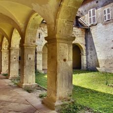
Prieuré de Mouthier-Haute-Pierre
752 m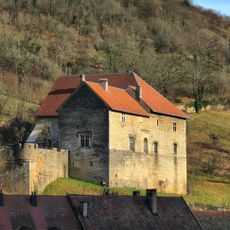
Château de Lods
1.2 km
Mouthier-Haute-Pierre - église Saint-Laurent
744 m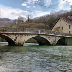
Pont sur la Loue de Mouthier-Haute-Pierre
830 m
Roche de Hautepierre
1.6 km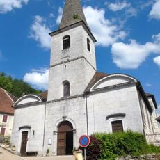
Église Saint-Théodule
1.4 km
Baume Archée
1.7 km
Maison, 16 rue Robert-Dame
604 m
Point de vue du Moine
1.2 km
Point de vue du Moine
1.2 km
Scenic viewpoint
1.6 km
Scenic viewpoint
3 m
Wayside cross
714 m
Wayside cross
436 m
Ancien Prieuré
765 m
Croix
625 m
Wayside cross
860 m
Croix
1 km
Wayside cross
7 m
Point de vue du Moine
1.2 km
Wayside shrine
880 m
Catholic church building, wayside shrine, Christianity
203 m
Wayside cross
1.6 km
Wayside shrine
1.7 km
Catholic church building, wayside cross, Christianity
1.4 km
Catholic church building, wayside shrine, Christianity
1.6 km
Wayside shrine
793 m
Waterfall
1.6 kmReviews
Visited this place? Tap the stars to rate it and share your experience / photos with the community! Try now! You can cancel it anytime.
Discover hidden gems everywhere you go!
From secret cafés to breathtaking viewpoints, skip the crowded tourist spots and find places that match your style. Our app makes it easy with voice search, smart filtering, route optimization, and insider tips from travelers worldwide. Download now for the complete mobile experience.

A unique approach to discovering new places❞
— Le Figaro
All the places worth exploring❞
— France Info
A tailor-made excursion in just a few clicks❞
— 20 Minutes