Les marches du temps
Location: Talloires
Location: Talloires-Montmin
GPS coordinates: 45.84039,6.21113
Latest update: November 16, 2025 15:10
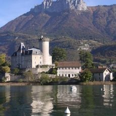
Château de Châteauvieux
1.4 km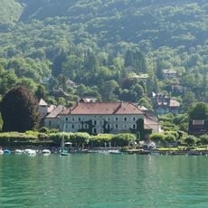
Abbaye de Talloires
119 m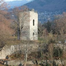
Château de Duingt
1.4 km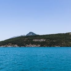
Roc de Chère National Nature Reserve
1.4 km
Oratoire de Thoron
377 m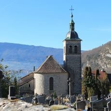
Église Saint-Maurice de Talloires
290 m
Villa Besnard
403 m
Roc de Chère
1.2 km
Scenic viewpoint
735 m
Scenic viewpoint
629 m
Grotte Saint-Germain
904 m
Scenic viewpoint
824 m
Belvédère de la Crête
651 m
Scenic viewpoint
913 m
Scenic viewpoint
895 m
Ponton de Talloires - Montmin
123 m
Statue de Claude-Louis Berthollet
271 m
Work of art, sculpture
856 m
Scenic viewpoint
771 m
Scenic viewpoint
1.4 km
Wayside cross
1.4 km
Wayside cross
1.4 km
Croix du Thoron
496 m
Wayside cross
1.2 km
Vierge
903 m
Wayside cross
1.3 km
Christianity, Catholic church building, wayside shrine
847 m
Cascade du Saut du Moine
961 mReviews
Visited this place? Tap the stars to rate it and share your experience / photos with the community! Try now! You can cancel it anytime.
Discover hidden gems everywhere you go!
From secret cafés to breathtaking viewpoints, skip the crowded tourist spots and find places that match your style. Our app makes it easy with voice search, smart filtering, route optimization, and insider tips from travelers worldwide. Download now for the complete mobile experience.

A unique approach to discovering new places❞
— Le Figaro
All the places worth exploring❞
— France Info
A tailor-made excursion in just a few clicks❞
— 20 Minutes