Dorfsäule
Location: Neuenhausen
Location: Grevenbroich
GPS coordinates: 51.07079,6.58853
Latest update: November 20, 2025 01:14
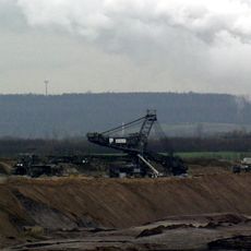
Vollrather Höhe
1.2 km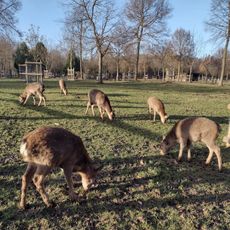
Wildfreigehege Bend
1.1 km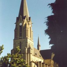
St. Mariä Himmelfahrt
1.5 km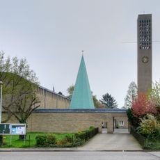
St. Josef
1.6 km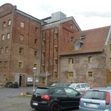
Gustorfer Mühle
1.2 km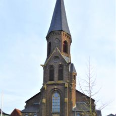
Church of St Cyriakus
60 m
LSG-Hanglagen der Vollrather Hoehe
1.1 km
LSG-Welchenberg
714 m
Franziskanerterziarenkloster St. Willibrord, Welchenberg
1.1 km
Memorial stone, memorial
1.5 km
Wayside cross
950 m
Bienen-Lehrstand
1.5 km
Sandhasen Plastik
35 m
Memorial
1.1 km
Bienen-Lehrstand
1.5 km
Heiligenhäuschen
310 m
St. Cyriakus
52 m
Willibrordus Heilbrunnen
949 m
Gewässer-Lehrpfad
1.5 km
Wayside cross
652 m
Wayside cross
603 m
Catholic church building, wayside cross, Christianity
1.3 km
Adele Gordon
1.6 km
Philipp Gordon
1.6 km
Moses Löwenthal
1.4 km
Helene Löwenthal
1.4 km
Berta Löwenthal
1.4 km
Isidor Löwenthal
1.4 kmReviews
Visited this place? Tap the stars to rate it and share your experience / photos with the community! Try now! You can cancel it anytime.
Discover hidden gems everywhere you go!
From secret cafés to breathtaking viewpoints, skip the crowded tourist spots and find places that match your style. Our app makes it easy with voice search, smart filtering, route optimization, and insider tips from travelers worldwide. Download now for the complete mobile experience.

A unique approach to discovering new places❞
— Le Figaro
All the places worth exploring❞
— France Info
A tailor-made excursion in just a few clicks❞
— 20 Minutes