Schutzpatron St. Markus
Location: Brannenburg
Inception: January 1, 1928
GPS coordinates: 47.72603,12.11090
Latest update: November 28, 2025 03:26
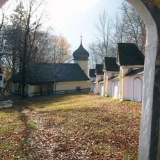
Wallfahrtskirche St. Maria Magdalena auf der Biber
419 m
Friedhofsmauer Biberhöhe 5 in Brannenburg
426 m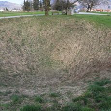
Doline Wolfsgrube bei Flintsbach
299 m
Kirche Biberhöhe 5 in Brannenburg
441 m
Kreuzwegstation Biberhöhe 5 in Brannenburg
439 m
Kreuzwegstation Biberhöhe 5 in Brannenburg
431 m
Kreuzwegstation Biberhöhe 5 in Brannenburg
454 m
Kreuzwegstation Biberhöhe 5 in Brannenburg
409 m
Kreuzwegstation Biberhöhe 5 in Brannenburg
445 m
Bethaus Biberhöhe 5 in Brannenburg
408 m
Kreuzwegstation Biberhöhe 5 in Brannenburg
438 m
Kreuzwegstation Biberhöhe 5 in Brannenburg
445 m
Kreuzwegstation Biberhöhe 5 in Brannenburg
457 m
Kreuzwegstation Biberhöhe 5 in Brannenburg
451 m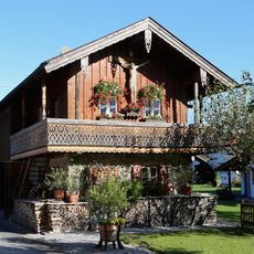
Biberstraße 51
390 m
Kreuzwegstation Biberhöhe 5 in Brannenburg
423 m
Kreuzwegstation Biberhöhe 5 in Brannenburg
433 m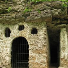
Biberklause
400 m
Kreuzwegstation Biberhöhe 5 in Brannenburg
416 m
Bichlbauer-Kreuz
352 m
Kletterer
150 m
Ehemalige Einsiedelei
390 m
Heiko Faust
399 m
Wayside cross
444 m
Wayside shrine
390 m
Wayside shrine
411 m
Wayside shrine
101 m
Wayside shrine
115 mReviews
Visited this place? Tap the stars to rate it and share your experience / photos with the community! Try now! You can cancel it anytime.
Discover hidden gems everywhere you go!
From secret cafés to breathtaking viewpoints, skip the crowded tourist spots and find places that match your style. Our app makes it easy with voice search, smart filtering, route optimization, and insider tips from travelers worldwide. Download now for the complete mobile experience.

A unique approach to discovering new places❞
— Le Figaro
All the places worth exploring❞
— France Info
A tailor-made excursion in just a few clicks❞
— 20 Minutes