Hörstein
Location: Neuenkirchen
Creator: Ulrich Eller
Made from material: stone
Creator: Ulrich Eller
GPS coordinates: 53.02053,9.73110
Latest update: July 20, 2025 16:09
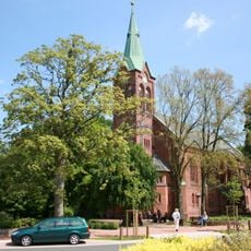
St. Bartholomäus
2.2 km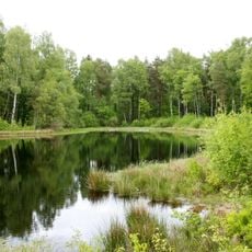
Riensheide mit Stichter See und Sägenmoor
2.1 km
Kunstverein & Stiftung Springhornhof
2.2 km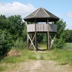
Observation tower, scenic viewpoint, tower
1.5 km
Riensheide
1.6 km
Riensheide
1.9 km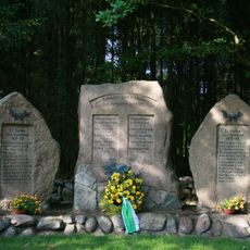
Kriegerdenkmal Gilmerdingen
1.2 km
War memorial, memorial
2 km
Split Ring Birch Mound
2.1 km
Scenic viewpoint
1.1 km
U. Schlumbohm 1931
1.8 km
Das blaue Haus
1.8 km
Memorial, war memorial
1.9 km
Himmel und Erde
970 m
War memorial, memorial
1.9 km
Wege
2 km
Waage
912 m
Work of art, sculpture
1.5 km
Wege
2.1 km
Ankommen
1.2 km
Steingarten
711 m
Springhornhof Institut für Paläolithische Archäologie
2.2 km
Aufgebäumter Stamm
627 m
Be-züge
2.2 km
Der Augenblick
2.2 km
Naturbad im Hahnenbachtal
2.3 km
Eiche tätowiert
2.3 km
Business Miles
2.3 kmReviews
Visited this place? Tap the stars to rate it and share your experience / photos with the community! Try now! You can cancel it anytime.
Discover hidden gems everywhere you go!
From secret cafés to breathtaking viewpoints, skip the crowded tourist spots and find places that match your style. Our app makes it easy with voice search, smart filtering, route optimization, and insider tips from travelers worldwide. Download now for the complete mobile experience.

A unique approach to discovering new places❞
— Le Figaro
All the places worth exploring❞
— France Info
A tailor-made excursion in just a few clicks❞
— 20 Minutes