Röder
Location: Rehlingen
Location: Rehlingen-Siersburg
GPS coordinates: 49.36423,6.69836
Latest update: November 20, 2025 02:05

Contiomagus
1.1 km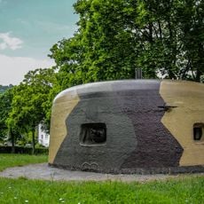
Westwallbunker
1.9 km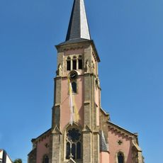
St. Maximin
1.4 km
Maria Trost
1.3 km
Museum Pachten
1.3 km
Treppenhaus
1.3 km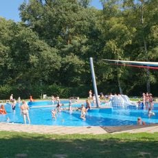
Freibad Dillingen
1.6 km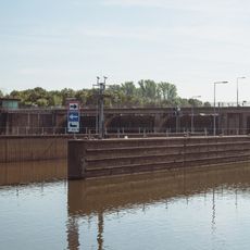
Staustufe Rehlingen
1.1 km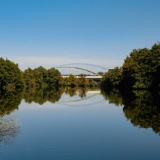
Franz-Josef-Röder-Brücke
57 m
Landschaftsschutzgebiet "Altarme der Saar" (L 6606-309)
1.7 km
Landschaftsschutzgebiet "Rastgebiete im mittleren Saartal" (L 6606-310)
686 m
{Landschaftsschutzgebiet im Landkreis Saarlouis - im Bereich der Gemeinden (Rehlingen und Wallerfangen) [Dillingen]}
1.7 km
Hoes-Berg
1.4 km
Beckinger Saaraltarm
1.8 km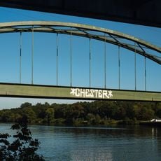
Eisenbahnbrücke
86 m
Altarme der Saar
775 m
Aussichtsturm am Dillinger See
819 m
Scenic viewpoint
819 m
Aussicht zw. Bäumen
1.1 km
Scenic viewpoint
1.4 km
WH 8
908 m
Endingersch Kreuz
1.5 km
Bellmannkreuz
1.2 km
Schnubel
931 m
Mordkreuz
1.2 km
Von Hausen 1766
1.8 km
Wayside shrine
1.8 km
Catholic church building, wayside cross, Christianity
1.7 kmReviews
Visited this place? Tap the stars to rate it and share your experience / photos with the community! Try now! You can cancel it anytime.
Discover hidden gems everywhere you go!
From secret cafés to breathtaking viewpoints, skip the crowded tourist spots and find places that match your style. Our app makes it easy with voice search, smart filtering, route optimization, and insider tips from travelers worldwide. Download now for the complete mobile experience.

A unique approach to discovering new places❞
— Le Figaro
All the places worth exploring❞
— France Info
A tailor-made excursion in just a few clicks❞
— 20 Minutes